|
search place name
|
||
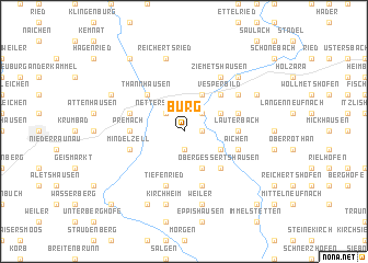
Burg (Bayern, Germany)Burg is a town in the Bayern region of Germany. An overview map of the region around Burg is displayed below.
regional and 3d topo map of Burg, Germany ::
Burg airports ::
The nearest airport is AGB - Augsburg, located 37.5 km north east of Burg.
Other airports nearby include FEL - Fuerstenfeldbruck Furstenfeldbruck (57.2 km east), OBF - Oberpfaffenhofen (61.2 km east), MUC - Munich Munchen (96.1 km east), FDH - Friedrichshafen (97.9 km south west), Nearby towns ::
Memmenhausen (1.2km east) //
Balzhausen (1.9km south) //
Kirrberg (1.9km south) //
Nachstetten (2.2km north east) //
Nettershausen (2.2km north west) //
Bauhofen (2.2km north east) //
Bernbach (3.1km south east) //
Hellersberg (3.1km north east) //
Ruhfelden (3.1km south east) //
Leutenbuch (3.9km south) //
Muttershofen (3.9km north) //
Thannhausen (4.5km north west) //
Obergessertshausen (4.5km south east) //
Vesperbild (4.5km north east) //
Premach (3.7km west) //
Lauterbach (3.7km east) //
Tiefenried (5.7km south) //
Haselbach (5.7km south) //
Aichen (4.1km south east) //
Mindelzell (4.1km south west) //
Seifriedsberg (4.1km north east) //
Ursberg (4.1km north west) //
Bayersried (4.1km north west) //
Ziemetshausen (6.1km north east) //
Vorderschellenbach (5.2km north east) //
Reichertsried (7.5km north) //
Kirchheim (7.5km south) //
Häuserhof (7.5km north) //
Weiler (7.5km south) //
[all distances 'as the bird flies' and approximate]  Places with similar names to Burg, Germany ::
Disclaimer :: Information on this page comes without warranty of any kind |
||
|
Where is Burg? Elevation and coordinates ::
Latitude (lat): 48°15'0"N Longitude (lon): 10°30'0"E
Elevation (approx.): 531m (map arrows pan, magnifying glasses zoom) |
||
|
Visiting Burg? Hotel/Accommodation ::
Book a hotel in Burg Travel Guide ::
Buy a travel guide for Germany rental cars ::
car rental offers GPS waypoint ::
download a GPX waypoint (PoI) of Burg for your GPS receiver
|
||