|
search place name
|
||
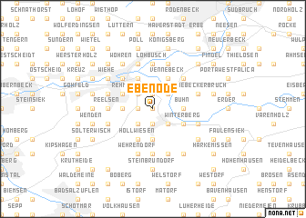
Ebenöde (Nordrhein-Westfalen, Germany)Ebenöde is a town in the Nordrhein-Westfalen region of Germany. An overview map of the region around Ebenöde is displayed below.
regional and 3d topo map of Ebenöde, Germany ::
Ebenöde airports ::
The nearest airport is GUT - Guetersloh Gutersloh, located 47.2 km south west of Ebenöde.
Other airports nearby include HAJ - Hannover (64.8 km north east), PAD - Paderborn Lippstadt (65.3 km south), FMO - Muenster/osnabrueck Munster Osnabruck (79.9 km west), ZCN - Celle (91.8 km north east), Nearby towns ::
Deesberg (0.0km north) //
Horst (1.9km south) //
Schierenbrink (1.9km south) //
Vlotho (1.9km south) //
Wölpke (1.1km west) //
Vössen (1.9km north) //
Babbenhausen (1.9km north) //
Mepke (2.2km south west) //
Bonneberg (2.2km south west) //
Uffeln (2.2km south east) //
Oberbecksen (2.2km north west) //
Holtrup (2.2km north east) //
Twellsiek (2.2km north east) //
Hüffe (2.2km north west) //
Busch (2.3km west) //
Kappenberg (2.3km west) //
Buhn (2.3km east) //
Bretthorst (3.7km south) //
Valdorf (3.7km south) //
Winterberg (2.9km south east) //
Rehme (2.9km north west) //
Bülte (2.9km north west) //
Bruch (2.9km north west) //
Bessingen (2.9km north west) //
Hollwiesen (3.9km south) //
Vennebeck (3.9km north) //
Hahnenkamp (3.9km north) //
Dörgen (4.3km north west) //
Helserbruch (4.3km north east) //
[all distances 'as the bird flies' and approximate] 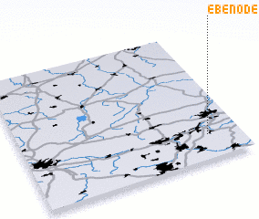 Places with similar names to Ebenöde, Germany ::
Disclaimer :: Information on this page comes without warranty of any kind |
||
|
Where is Ebenöde? Elevation and coordinates ::
Latitude (lat): 52°11'0"N Longitude (lon): 8°51'0"E
Elevation (approx.): 154m (map arrows pan, magnifying glasses zoom) |
||
|
Visiting Ebenöde? Hotel/Accommodation ::
Book a hotel in Ebenöde Travel Guide ::
Buy a travel guide for Germany rental cars ::
car rental offers GPS waypoint ::
download a GPX waypoint (PoI) of Ebenöde for your GPS receiver
|
||