|
search place name
|
||
Hinterwald (Baden-Württemberg, Germany)Hinterwald is a town in the Baden-Württemberg region of Germany. An overview map of the region around Hinterwald is displayed below.
regional and 3d topo map of Hinterwald, Germany ::

Hinterwald airports ::
The nearest airport is STR - Stuttgart, located 64.7 km south west of Hinterwald.
Other airports nearby include GHF - Giebelstadt Aaf (73.9 km north), AGB - Augsburg (93.4 km south east), NUE - Nuernberg Nurnberg (97.5 km north east), ZQC - Speyer (117.3 km west), Nearby towns ::
Mittelwald (0.0km north) //
Hochbronn (1.2km west) //
Röhmen (1.2km east) //
Haid (2.2km south west) //
Stöcken (2.2km south west) //
Wendenhof (2.2km south west) //
Vorderwald (2.2km south east) //
Ottenhof (2.2km south east) //
Schönbronn (2.4km west) //
Hütten (2.4km east) //
Bühler (3.9km south) //
Zimmerberg (3.9km south) //
Mangoldshausen (3.1km north west) //
Gaishardt (3.1km south east) //
Kammerstatt (3.8km north west) //
Zollhof (5.0km north) //
Adelmannsfelden (4.4km south east) //
Rosenberg (4.4km north east) //
Pommertsweiler (5.6km south) //
Hinterbrand (3.6km east) //
Senzenberg (3.6km west) //
Betzenhof (5.6km north) //
Wildenhäusle (5.7km south) //
Lutstrut (5.7km south) //
Wildenhof (5.7km south) //
Steinenbühl (4.1km south west) //
Willa (5.7km north) //
Hochtänn (5.7km north) //
Holenstein (5.1km north west) //
[all distances 'as the bird flies' and approximate] 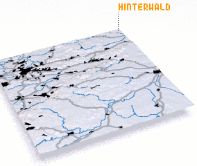 Places with similar names to Hinterwald, Germany ::
// Hinterwald (DE)
Disclaimer :: Information on this page comes without warranty of any kind |
||
|
Where is Hinterwald? Elevation and coordinates ::
Latitude (lat): 48°59'0"N Longitude (lon): 9°59'0"E
Elevation (approx.): 470m (map arrows pan, magnifying glasses zoom) |
||
|
Visiting Hinterwald? Hotel/Accommodation ::
Book a hotel in Hinterwald Travel Guide ::
Buy a travel guide for Germany rental cars ::
car rental offers GPS waypoint ::
download a GPX waypoint (PoI) of Hinterwald for your GPS receiver
|
||