|
search place name
|
||
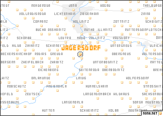
Jägersdorf (Thüringen, Germany)Jägersdorf is a town in the Thüringen region of Germany. An overview map of the region around Jägersdorf is displayed below.
regional and 3d topo map of Jägersdorf, Germany ::
Jägersdorf airports ::
The nearest airport is ERF - Erfurt, located 48.0 km west of Jägersdorf.
Other airports nearby include HOQ - Hof Plauen (63.2 km south), AOC - Altenburg Nobitz (65.9 km east), LEJ - Leipzig Halle (80.4 km north east), BYU - Bayreuth (94.5 km south), Nearby towns ::
Kleinpürschütz (0.0km north) //
Schöps (0.0km north) //
Großpürschütz (1.9km south) //
Altendorf (1.2km west) //
Rothenstein (1.9km north) //
Oelknitz (2.2km north east) //
Löbschütz (3.7km south) //
Maua (3.7km north) //
Seitenroda (3.9km south) //
Kahla (3.9km south) //
Leuchtenburg (3.9km south) //
Sulza (3.9km north) //
Leutra (4.4km north west) //
Zöllnitz (4.4km north east) //
Schiebelau (4.4km north east) //
Göschwitz (5.6km north) //
Lindig (5.6km south) //
Greuda (3.5km west) //
Magersdorf (3.5km east) //
Zwabitz (4.0km south west) //
Unterbodnitz (4.0km south east) //
Rutha (5.7km north) //
Kleineutersdorf (5.7km south) //
Schirnewitz (4.0km north west) //
Großbockedra (4.0km north east) //
Kleinbockedra (4.0km north east) //
Großeutersdorf (6.0km south west) //
Großlohma (6.0km north west) //
Drackendorf (6.0km north east) //
[all distances 'as the bird flies' and approximate] 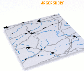 Places with similar names to Jägersdorf, Germany ::
// Jägersdorf (DE)
Disclaimer :: Information on this page comes without warranty of any kind |
||
|
Where is Jägersdorf? Elevation and coordinates ::
Latitude (lat): 50°50'0"N Longitude (lon): 11°36'0"E
Elevation (approx.): 156m (map arrows pan, magnifying glasses zoom) |
||
|
Visiting Jägersdorf? Hotel/Accommodation ::
Book a hotel in Jägersdorf Travel Guide ::
Buy a travel guide for Germany rental cars ::
car rental offers GPS waypoint ::
download a GPX waypoint (PoI) of Jägersdorf for your GPS receiver
|
||