|
search place name
|
||
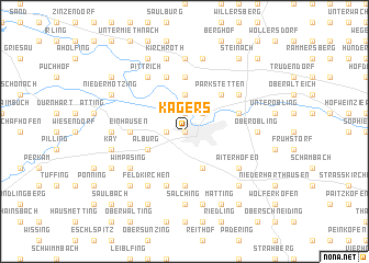
Kagers (Bayern, Germany)Kagers is a town in the Bayern region of Germany. An overview map of the region around Kagers is displayed below.
regional and 3d topo map of Kagers, Germany ::
Kagers airports ::
The nearest airport is MUC - Munich Munchen, located 82.3 km south west of Kagers.
Other airports nearby include FEL - Fuerstenfeldbruck Furstenfeldbruck (122.0 km south west), SZG - Salzburg (125.5 km south), NUE - Nuernberg Nurnberg (129.0 km north west), OBF - Oberpfaffenhofen (130.2 km south west), Nearby towns ::
Straubing (0.0km north) //
Frauenbründl (1.2km west) //
Sossau (1.9km north) //
Hornstorf (2.2km north east) //
Unterzeitldorn (3.7km north) //
Innerhienthal (3.9km south) //
Alburg (3.1km south west) //
Oberparkstetten (4.4km north east) //
Parkstetten (4.4km north east) //
Ehethal (5.6km south) //
Einhausen (3.7km west) //
Friedenhain (5.6km north) //
Mitterharthausen (5.7km south) //
Hofstetten (4.1km north east) //
Kößnach (5.7km north) //
Aiterhofen (5.2km south east) //
Hierlbach (5.2km south west) //
Wimpasing (5.2km south west) //
Weiling (6.1km south west) //
Feldkirchen (6.1km south west) //
Unterparkstetten (5.2km north east) //
Reibersdorf (5.2km north east) //
Pittrich (6.1km north west) //
Salching (7.4km south) //
Ittling (4.9km east) //
Oberöbling (4.9km east) //
Rinkam (4.9km west) //
Münster (7.4km north) //
Piering (7.5km south) //
[all distances 'as the bird flies' and approximate]  Places with similar names to Kagers, Germany ::
Disclaimer :: Information on this page comes without warranty of any kind |
||
|
Where is Kagers? Elevation and coordinates ::
Latitude (lat): 48°53'0"N Longitude (lon): 12°34'0"E
Elevation (approx.): 327m (map arrows pan, magnifying glasses zoom) |
||
|
Visiting Kagers? Hotel/Accommodation ::
Book a hotel in Kagers Travel Guide ::
Buy a travel guide for Germany rental cars ::
car rental offers GPS waypoint ::
download a GPX waypoint (PoI) of Kagers for your GPS receiver
|
||