|
search place name
|
||
Kallenbeck (Nordrhein-Westfalen, Germany)Kallenbeck is a town in the Nordrhein-Westfalen region of Germany. An overview map of the region around Kallenbeck is displayed below.
regional and 3d topo map of Kallenbeck, Germany ::

Kallenbeck airports ::
The nearest airport is ENS - Enschede Twenthe, located 22.5 km north west of Kallenbeck.
Other airports nearby include FMO - Muenster/osnabrueck Munster Osnabruck (38.9 km east), DTM - Dortmund (76.5 km south east), ESS - Essen Mulheim (82.3 km south), GUT - Guetersloh Gutersloh (84.9 km east), Nearby towns ::
Nienborg (1.1km west) //
Heek (2.2km south west) //
Averbeck (3.9km south) //
Wext (2.9km north west) //
Füchte (4.3km north west) //
Wichum (3.4km west) //
Gemen (5.7km south) //
Weinerbauerschaft (6.0km north) //
Frettholt (7.5km south) //
Gerdingseite (4.9km west) //
Langeseite (4.9km west) //
Ahle (5.9km south west) //
Horst und Wall (8.7km north east) //
Am Berge (8.7km north west) //
[all distances 'as the bird flies' and approximate] 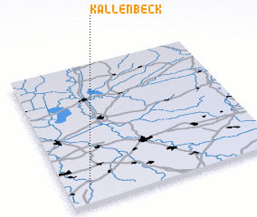 Places with similar names to Kallenbeck, Germany ::
// Galenbeck (DE)
// Galenbeck (DE)
// Kleinbocka (DE)
// Klein Buckow (DE)
// Kleinbuckow (DE)
// Kohlenbek (DE)
// Kolonia Boćki (PL)
// Kolonia Byki (PL)
// Glenboka (UA)
// Kolonbek (RU)
Disclaimer :: Information on this page comes without warranty of any kind |
||
|
Where is Kallenbeck? Elevation and coordinates ::
Latitude (lat): 52°8'0"N Longitude (lon): 7°7'0"E
Elevation (approx.): 53m (map arrows pan, magnifying glasses zoom) |
||
|
Visiting Kallenbeck? Hotel/Accommodation ::
Book a hotel in Kallenbeck Travel Guide ::
Buy a travel guide for Germany rental cars ::
car rental offers GPS waypoint ::
download a GPX waypoint (PoI) of Kallenbeck for your GPS receiver
|
||