|
search place name
|
||
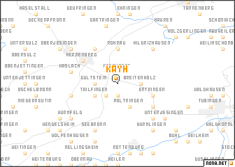
Kayh (Baden-Württemberg, Germany)Kayh is a town in the Baden-Württemberg region of Germany. An overview map of the region around Kayh is displayed below.
regional and 3d topo map of Kayh, Germany ::
Kayh airports ::
The nearest airport is STR - Stuttgart, located 26.3 km north east of Kayh.
Other airports nearby include ZCC - Baden-baden Baden Oos (59.2 km north west), ZQL - Donaueschingen Villingen (72.2 km south west), ZQC - Speyer (88.7 km north), SXB - Strassbourg Entzheim (95.2 km west), Nearby towns ::
Mönchberg (1.9km north) //
Reusten (1.9km south) //
Altingen (2.2km south west) //
Breitenholz (2.5km east) //
Gültstein (2.5km west) //
Oberndorf (3.9km south) //
Poltringen (3.9km south) //
Tailfingen (3.1km south west) //
Holzhausen (5.6km north) //
Rohrau (5.6km north) //
Entringen (4.1km south east) //
Affstätt (5.2km north west) //
Herrenberg (5.2km north west) //
Hailfingen (5.2km south east) //
Nufringen (6.1km north west) //
Haslach (5.2km west) //
Nebringen (5.2km west) //
Pfäffingen (6.7km south east) //
Hildrizhausen (6.7km north east) //
Seebronn (7.8km south) //
Unterjesingen (7.4km south east) //
Wurmlingen (8.3km south east) //
Wurmfeld (7.4km south west) //
Kuppingen (7.4km north west) //
[all distances 'as the bird flies' and approximate] 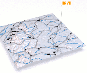 Places with similar names to Kayh, Germany ::
Disclaimer :: Information on this page comes without warranty of any kind |
||
|
Where is Kayh? Elevation and coordinates ::
Latitude (lat): 48°34'0"N Longitude (lon): 8°55'0"E
Elevation (approx.): 410m (map arrows pan, magnifying glasses zoom) |
||
|
Visiting Kayh? Hotel/Accommodation ::
Book a hotel in Kayh Travel Guide ::
Buy a travel guide for Germany rental cars ::
car rental offers GPS waypoint ::
download a GPX waypoint (PoI) of Kayh for your GPS receiver
|
||