|
search place name
|
||
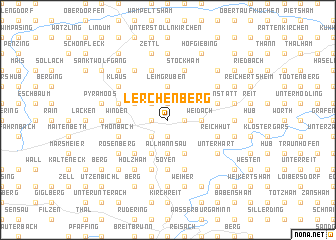
Lerchenberg (Bayern, Germany)Lerchenberg is a town in the Bayern region of Germany. An overview map of the region around Lerchenberg is displayed below.
regional and 3d topo map of Lerchenberg, Germany ::
Lerchenberg airports ::
The nearest airport is MUC - Munich Munchen, located 37.1 km north west of Lerchenberg.
Other airports nearby include OBF - Oberpfaffenhofen (68.9 km west), FEL - Fuerstenfeldbruck Furstenfeldbruck (69.5 km west), SZG - Salzburg (73.0 km south east), AGB - Augsburg (98.4 km west), Nearby towns ::
Kirchdorf (1.9km north) //
Asen (1.9km north) //
Rainbach (1.2km west) //
Anfelden (1.2km east) //
Haag in Oberbayern (1.2km west) //
Furth (1.2km east) //
Aicha (1.9km south) //
Berg (2.2km north west) //
Altdorf (2.2km south west) //
Schlicht (2.5km east) //
Ramsau (2.5km east) //
Weidach (2.5km east) //
Leimgruben (3.7km north) //
Fürholzen (3.7km north) //
Allmannsau (3.7km south) //
Diezmanning (3.1km north west) //
Burreit (3.9km south) //
Neuberg (3.9km south) //
Lengmoos (3.9km south) //
Hochhaus (4.5km south west) //
Blümöd (4.5km south west) //
Soyen (5.6km south) //
Rottenhub (5.6km south) //
Winden (3.7km west) //
Obermoosham (4.1km north west) //
Untermoosham (4.1km north west) //
Moosham (4.1km north west) //
Tiefenstätt (4.1km north east) //
Pürstling am Parstling (5.7km north) //
[all distances 'as the bird flies' and approximate]  Places with similar names to Lerchenberg, Germany ::
Disclaimer :: Information on this page comes without warranty of any kind |
||
|
Where is Lerchenberg? Elevation and coordinates ::
Latitude (lat): 48°10'0"N Longitude (lon): 12°12'0"E
Elevation (approx.): 519m (map arrows pan, magnifying glasses zoom) |
||
|
Visiting Lerchenberg? Hotel/Accommodation ::
Book a hotel in Lerchenberg Travel Guide ::
Buy a travel guide for Germany rental cars ::
car rental offers GPS waypoint ::
download a GPX waypoint (PoI) of Lerchenberg for your GPS receiver
|
||