|
search place name
|
||
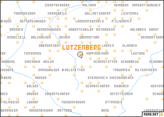
Lutzenberg (Bayern, Germany)Lutzenberg is a town in the Bayern region of Germany. An overview map of the region around Lutzenberg is displayed below.
regional and 3d topo map of Lutzenberg, Germany ::
Lutzenberg airports ::
The nearest airport is AGB - Augsburg, located 36.0 km north east of Lutzenberg.
Other airports nearby include FEL - Fuerstenfeldbruck Furstenfeldbruck (50.8 km east), OBF - Oberpfaffenhofen (53.7 km east), MUC - Munich Munchen (90.9 km east), FDH - Friedrichshafen (99.3 km south west), Nearby towns ::
Reichertshofen (1.2km east) //
Ellenried (1.9km south) //
Könghausen (2.2km south west) //
Mittelneufnach (2.2km south east) //
Walkertshofen (3.7km north) //
Hölden (3.7km north) //
Köpfingerhof (2.5km east) //
Immelstetten (3.9km south) //
Buchhof (3.9km south) //
Oberrothan (3.9km north) //
Grimoldsried (3.1km north east) //
Kelchsried (3.1km north east) //
Aichen (4.5km north west) //
Gumpenweiler (5.6km north) //
Habertsweiler (5.6km north) //
Erkhausen (3.7km east) //
Bürgle (5.6km south) //
Obergessertshausen (4.1km north west) //
Rielhofen (4.1km north east) //
Scherstetten (4.1km south east) //
Anhofen (5.7km south) //
Oberneufnach (5.7km south) //
Ruhfelden (5.2km north west) //
Bernbach (5.2km north west) //
Lauterbach (6.1km north west) //
Münster (5.2km north east) //
Steinekirch (6.1km south east) //
Haselbach (4.9km west) //
Konradshofen (4.9km east) //
[all distances 'as the bird flies' and approximate] 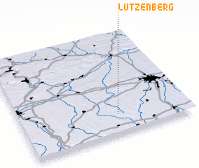 Places with similar names to Lutzenberg, Germany ::
// Lutzenberg (DE)
// Litzenberg (US)
Disclaimer :: Information on this page comes without warranty of any kind |
||
|
Where is Lutzenberg? Elevation and coordinates ::
Latitude (lat): 48°12'0"N Longitude (lon): 10°35'0"E
Elevation (approx.): 603m (map arrows pan, magnifying glasses zoom) |
||
|
Visiting Lutzenberg? Hotel/Accommodation ::
Book a hotel in Lutzenberg Travel Guide ::
Buy a travel guide for Germany rental cars ::
car rental offers GPS waypoint ::
download a GPX waypoint (PoI) of Lutzenberg for your GPS receiver
|
||