|
search place name
|
||
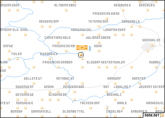
Oha (Schleswig-Holstein, Germany)Oha is a town in the Schleswig-Holstein region of Germany. An overview map of the region around Oha is displayed below.
regional and 3d topo map of Oha, Germany ::
Oha airports ::
The nearest airport is KEL - Kiel Holtenau, located 45.4 km east of Oha.
Other airports nearby include SGD - Soenderborg Sonderborg (78.7 km north), HAM - Hamburg (80.3 km south east), XFW - Hamburg Finkenwerder (86.7 km south), LBC - Luebeck Lubeck Blankensee (97.8 km south east), Nearby towns ::
Sophienhamm (0.0km north) //
Bargstall (1.9km south) //
Westermühlen (2.8km south east) //
Hohn (2.8km north east) //
Friedrichsholm (2.8km north west) //
Julianenebene (4.3km north east) //
Königshügel (5.6km north) //
Hamdorfweide (5.6km south) //
Friedrichsgraben (3.7km south west) //
Elsdorf-Westermühlen (3.7km south east) //
Föhrden (6.0km north) //
Christiansholm (4.9km north west) //
Rethbucht (6.0km south) //
Eiderdeich (4.3km west) //
Elsdorf (4.7km south east) //
Prinzenmoor (7.5km south) //
Tetenhusen (7.7km north) //
Lohe-Föhrden (7.0km north east) //
Altenfähre (8.1km south west) //
Neuenfähre (8.1km south west) //
Hamdorf (7.0km south east) //
Huy (8.1km south east) //
Wrohm (8.6km south west) //
Meggerdorf (8.6km north west) //
[all distances 'as the bird flies' and approximate] 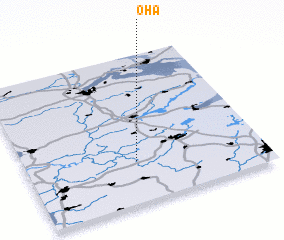 Places with similar names to Oha, Germany ::
Disclaimer :: Information on this page comes without warranty of any kind |
||
|
Where is Oha? Elevation and coordinates ::
Latitude (lat): 54°17'0"N Longitude (lon): 9°28'0"E
Elevation (approx.): -2m (map arrows pan, magnifying glasses zoom) |
||
|
Visiting Oha? Hotel/Accommodation ::
Book a hotel in Oha Travel Guide ::
Buy a travel guide for Germany rental cars ::
car rental offers GPS waypoint ::
download a GPX waypoint (PoI) of Oha for your GPS receiver
|
||