|
search place name
|
||
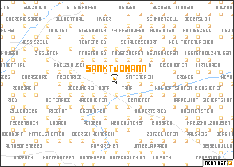
Sankt Johann (Bayern, Germany)Sankt Johann is a town in the Bayern region of Germany. An overview map of the region around Sankt Johann is displayed below.
regional and 3d topo map of Sankt Johann, Germany ::
Sankt Johann airports ::
The nearest airport is FEL - Fuerstenfeldbruck Furstenfeldbruck, located 15.0 km south of Sankt Johann.
Other airports nearby include AGB - Augsburg (22.3 km north west), OBF - Oberpfaffenhofen (28.7 km south), MUC - Munich Munchen (43.5 km east), INN - Innsbruck (119.8 km south), Nearby towns ::
Miegersbach (1.9km south) //
Odelzhausen (1.9km south) //
Sixtnitgern (1.2km east) //
Höfa (2.2km south west) //
Hadersried (2.2km south west) //
Taxa (2.2km south east) //
Roßbach (2.2km south east) //
Hohenzell (2.2km north west) //
Irchenbrunn (2.2km north east) //
Sittenbach (2.5km east) //
Todtenried (3.7km south) //
Übelmanna (3.7km north) //
Unterumbach (3.1km south west) //
Essenbach (3.1km south east) //
Tremmel (3.1km north west) //
Michelau (3.1km north west) //
Plixenried (3.1km north east) //
Langengern (3.1km north east) //
Lukka (3.9km south) //
Dietenhausen (3.9km south) //
Radenzhofen (3.9km north) //
Lichtenberg (3.9km north) //
Kiemertshofen (3.9km north) //
Holzgrub (3.9km north) //
Pfaffenhofen an der Glonn (4.5km south west) //
Wagenhofen (4.5km south west) //
Orthofen (4.5km south east) //
Wiedenzhausen (4.5km south east) //
Irschenhofen (4.5km north west) //
[all distances 'as the bird flies' and approximate]  Places with similar names to Sankt Johann, Germany ::
// Sankt Johann (CH)
// Sankt Johann (AT)
// Sankt Johann (AT)
// Sankt Johann (AT)
// Sankt Johann (AT)
// Sankt Johann (AT)
// Sankt Johann (DE)
// Sankt Johann (DE)
// Sankt Johann (DE)
// Sankt Johann (DE)
Disclaimer :: Information on this page comes without warranty of any kind |
||
|
Where is Sankt Johann? Elevation and coordinates ::
Latitude (lat): 48°20'0"N Longitude (lon): 11°12'0"E
Elevation (approx.): 507m (map arrows pan, magnifying glasses zoom) |
||
|
Visiting Sankt Johann? Hotel/Accommodation ::
Book a hotel in Sankt Johann Travel Guide ::
Buy a travel guide for Germany rental cars ::
car rental offers GPS waypoint ::
download a GPX waypoint (PoI) of Sankt Johann for your GPS receiver
|
||