|
search place name
|
||
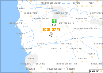
I Palazzi (Italy)I Palazzi is a town in Italy. An overview map of the region around I Palazzi is displayed below.
regional and 3d topo map of I Palazzi, Italy ::
I Palazzi airports ::
The nearest airport is PSA - Pisa, located 5.7 km north of I Palazzi.
Other airports nearby include FLR - Firenze (69.1 km east), SAY - Siena Ampugnano (82.1 km south east), EBA - Marina Di Campo (97.7 km south), GRS - Grosseto (112.0 km south east), Nearby towns ::
Coltano (1.3km east) //
Casa dellʼIsola (2.3km south east) //
Casa San Guido (3.3km north west) //
Casa Poggio al Lupo (4.6km south west) //
Stagno (4.6km south west) //
Guasticce (5.7km south) //
Mortaiolo (5.5km south east) //
San Piero a Grado (6.2km north west) //
Ponte Arpiglio (5.5km north east) //
Nugola (6.9km south east) //
Ospedaletto (7.9km north) //
La Palazzina (9.1km north west) //
[all distances 'as the bird flies' and approximate] 
Disclaimer :: Information on this page comes without warranty of any kind |
||
|
Where is I Palazzi? Elevation and coordinates ::
Latitude (lat): 43°38'0"N Longitude (lon): 10°23'0"E
Elevation (approx.): 13m (map arrows pan, magnifying glasses zoom) |
||
|
Visiting I Palazzi? Hotel/Accommodation ::
Book a hotel in I Palazzi Travel Guide ::
Buy a travel guide for Italy rental cars ::
car rental offers GPS waypoint ::
download a GPX waypoint (PoI) of I Palazzi for your GPS receiver
|
||