|
search place name
|
||
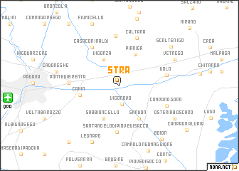
Stra (Veneto, Italy)Stra is a town in the Veneto region of Italy. An overview map of the region around Stra is displayed below.
regional and 3d topo map of Stra, Italy ::
Stra airports ::
The nearest airport is QPA - Padova, located 12.5 km west of Stra.
Other airports nearby include VCE - Venice Venezia Tessera (29.0 km east), TSF - Treviso (30.0 km north east), VIC - Vicenza (41.2 km north west), AVB - Aviano Ab (Pagliano E Gori) (82.7 km north east), Nearby towns ::
Vigonovo (2.9km south) //
Vigonza (4.4km north west) //
Pianiga (5.2km north) //
Sabbioncello (5.5km south) //
Sandon (5.6km south east) //
Camin (4.6km west) //
SantʼAngelo di Piove di Sacco (7.3km south) //
Casa Corinaldi (6.7km north west) //
Dolo (5.5km east) //
Madonna Mora (7.8km north) //
Caltana (7.7km north) //
Ponte di Brenta (5.6km west) //
Camponogara (6.1km south east) //
Vetrego (7.3km north east) //
Legnaro (9.4km south) //
Osteria Boscaro (8.0km south east) //
Scaltenigo (8.4km north east) //
Boion (9.7km south east) //
Roncaiette (10.5km south west) //
[all distances 'as the bird flies' and approximate] 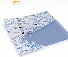 Places with similar names to Stra, Italy ::
Disclaimer :: Information on this page comes without warranty of any kind |
||
|
Where is Stra? Elevation and coordinates ::
Latitude (lat): 45°24'48"N Longitude (lon): 12°0'20"E
Elevation (approx.): 6m (map arrows pan, magnifying glasses zoom) |
||
|
Visiting Stra? Hotel/Accommodation ::
Book a hotel in Stra Travel Guide ::
Buy a travel guide for Italy rental cars ::
car rental offers GPS waypoint ::
download a GPX waypoint (PoI) of Stra for your GPS receiver
|
||