|
search place name
|
||
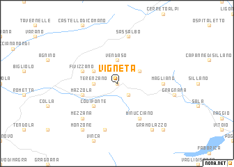
Vigneta (Italy)Vigneta is a town in Italy. An overview map of the region around Vigneta is displayed below.
regional and 3d topo map of Vigneta, Italy ::
Vigneta airports ::
The nearest airport is PSA - Pisa, located 61.5 km south of Vigneta.
Other airports nearby include PMF - Parma (68.1 km north), QPZ - Piacenza (85.6 km north west), FLR - Firenze (93.6 km south east), BLQ - Bologna (94.9 km east), Nearby towns ::
Rensa (0.0km north) //
Pugliano (2.3km south east) //
Casola in Lunigiana (2.3km south east) //
Terenzano (2.7km west) //
Vendaso (3.7km north) //
Collegnago (3.2km north west) //
Regnano (3.2km north east) //
Codiponte (4.6km south west) //
Fivizzano (4.4km north west) //
Mazzola (4.4km south west) //
Minucciano (6.2km south east) //
Magliano (5.3km east) //
Sassalbo (7.5km north) //
Equi Terme (7.5km south) //
Mezzana (6.8km south west) //
Monzone (8.4km south west) //
Gramolazzo (8.4km south east) //
Gorfigliano (9.1km south east) //
[all distances 'as the bird flies' and approximate] 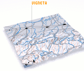 Places with similar names to Vigneta, Italy ::
Disclaimer :: Information on this page comes without warranty of any kind |
||
|
Where is Vigneta? Elevation and coordinates ::
Latitude (lat): 44°13'0"N Longitude (lon): 10°11'0"E
Elevation (approx.): 493m (map arrows pan, magnifying glasses zoom) |
||
|
Visiting Vigneta? Hotel/Accommodation ::
Book a hotel in Vigneta Travel Guide ::
Buy a travel guide for Italy rental cars ::
car rental offers GPS waypoint ::
download a GPX waypoint (PoI) of Vigneta for your GPS receiver
|
||