|
search place name
|
||
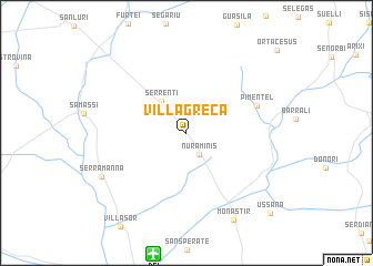
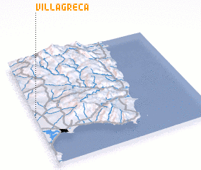
Villagreca (Sardegna, Italy)Villagreca is a town in the Sardegna region of Italy. An overview map of the region around Villagreca is displayed below.
regional and 3d topo map of Villagreca, Italy ::
Villagreca airports ::
The nearest airport is DCI - Decimomannu, located 12.5 km south of Villagreca.
Other airports nearby include CAG - Cagliari Elmas (24.1 km south), TTB - Tortoli (77.2 km north east), AHO - Alghero (143.1 km north west), OLB - Olbia Costa Smeralda (165.2 km north), Nearby towns ::
 Places with similar names to Villagreca, Italy ::
// Val'karkay (RU)
// Valkarkoy (RU)
// Val'korkey (RU)
// Valley Creek (US)
// Fall Creek (US)
// Vilkrāgģi (LV)
// Fly Creek (US)
// Falkirk (US)
// Fall Creek (US)
// Fall Creek (US)
Disclaimer :: Information on this page comes without warranty of any kind |
||
|
Where is Villagreca? Elevation and coordinates ::
Latitude (lat): 39°27'52"N Longitude (lon): 9°0'6"E
Elevation (approx.): 118m (map arrows pan, magnifying glasses zoom) |
||
|
Visiting Villagreca? Hotel/Accommodation ::
Book a hotel in Villagreca Travel Guide ::
Buy a travel guide for Italy rental cars ::
car rental offers GPS waypoint ::
download a GPX waypoint (PoI) of Villagreca for your GPS receiver
|
||