|
search place name
|
||
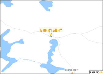
Barrys Bay (Ontario, Canada)Barrys Bay is a town in the Ontario region of Canada. An overview map of the region around Barrys Bay is displayed below.
regional and 3d topo map of Barrys Bay, Canada ::
Barrys Bay airports ::
The nearest airport is YWA - Petawawa, located 59.3 km north east of Barrys Bay.
Other airports nearby include YQA - Muskoka (139.2 km south west), YPQ - Peterborough (149.3 km south), YTR - Trenton (152.1 km south), YMW - Maniwaki (158.0 km north east), Nearby towns ::
[all distances 'as the bird flies' and approximate] 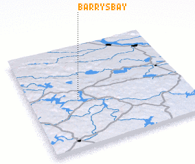 Places with similar names to Barrys Bay, Canada ::
// Borşa-Baia (RO)
// Baraseba (ZA)
// Bruce Bay (NZ)
// Barzāb (IR)
// Berāsb (IR)
// Bresibi (NG)
// Berseba (NA)
// Borisubi (PG)
// Biʼr aş Şabāḩ (SY)
// Barrys Bay (NZ)
Disclaimer :: Information on this page comes without warranty of any kind |
||
|
Where is Barrys Bay? Elevation and coordinates ::
Latitude (lat): 45°29'0"N Longitude (lon): 77°41'0"W
Elevation (approx.): 315m (map arrows pan, magnifying glasses zoom) |
||
|
Visiting Barrys Bay? Hotel/Accommodation ::
Book a hotel in Barrys Bay Travel Guide ::
Buy a travel guide for Canada rental cars ::
car rental offers GPS waypoint ::
download a GPX waypoint (PoI) of Barrys Bay for your GPS receiver
|
||