|
search place name
|
||
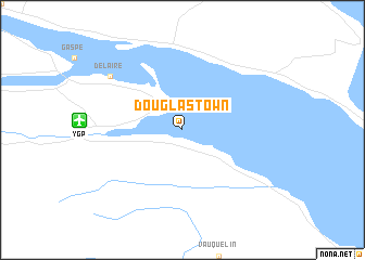
Douglastown (Québec, Canada)Douglastown is a town in the Québec region of Canada. An overview map of the region around Douglastown is displayed below.
regional and 3d topo map of Douglastown, Canada ::
Douglastown airports ::
The nearest airport is YGP - Gaspe, located 7.1 km west of Douglastown.
Other airports nearby include YPN - Port Menier (119.2 km north), YCL - Charlo (168.0 km south west), YCH - Chatham Miramichi (211.2 km south west), YZV - Sept-iles Sept Iles (211.7 km north west), Nearby towns ::
Delaire (7.4km north west) //
[all distances 'as the bird flies' and approximate]  Places with similar names to Douglastown, Canada ::
Disclaimer :: Information on this page comes without warranty of any kind |
||
|
Where is Douglastown? Elevation and coordinates ::
Latitude (lat): 48°46'0"N Longitude (lon): 64°23'0"W
Elevation (approx.): 26m (map arrows pan, magnifying glasses zoom) |
||
|
Visiting Douglastown? Hotel/Accommodation ::
Book a hotel in Douglastown Travel Guide ::
Buy a travel guide for Canada rental cars ::
car rental offers GPS waypoint ::
download a GPX waypoint (PoI) of Douglastown for your GPS receiver
|
||