|
search place name
|
||
Beang (Bomi, Liberia)Beang is a town in the Bomi region of Liberia. An overview map of the region around Beang is displayed below.
regional and 3d topo map of Beang, Liberia ::

Beang airports ::
The nearest airport is MLW - Monrovia Spriggs Payne, located 32.8 km south east of Beang.
Other airports nearby include ROB - Monrovia Roberts Intl (70.0 km south east), Nearby towns ::
Mima (1.9km north west) //
Belesii (2.0km south) //
Kpatia (2.1km south west) //
Laagbe (2.3km north west) //
Baama (2.3km north west) //
Be Seke (2.9km north) //
Coffeelo (3.3km south west) //
Kapebli (3.3km south west) //
Bima (3.5km east) //
Gowien Town (3.6km east) //
Zown Town (3.6km east) //
Sinje (3.6km west) //
Be Crusoe (3.8km north west) //
Diang (3.8km north east) //
Samukaja (4.0km west) //
Pehflem (4.4km south east) //
Togee (4.4km north west) //
Gondama Free Town (4.6km north east) //
Be Kena (4.6km north east) //
Royesville (4.8km south east) //
Gbotoja (4.8km north west) //
Gombai (5.2km north west) //
Sass Town (5.2km north east) //
Golodee Number Two (5.4km north east) //
Golodi (5.5km east) //
Kanga (5.5km east) //
Gbenang (5.8km west) //
Taylor Town (5.9km north east) //
Besali (5.9km north east) //
[all distances 'as the bird flies' and approximate] 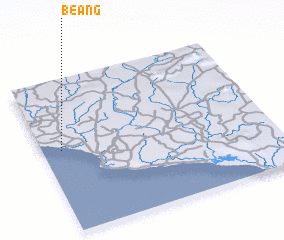 Places with similar names to Beang, Liberia ::
Disclaimer :: Information on this page comes without warranty of any kind |
||
|
Where is Beang? Elevation and coordinates ::
Latitude (lat): 6°32'26"N Longitude (lon): 10°54'55"W
Elevation (approx.): 22m (map arrows pan, magnifying glasses zoom) |
||
|
Visiting Beang? Hotel/Accommodation ::
Book a hotel in Beang Travel Guide ::
Buy a travel guide for Liberia rental cars ::
car rental offers GPS waypoint ::
download a GPX waypoint (PoI) of Beang for your GPS receiver
|
||