|
search place name
|
||
Kadibli (Grand Bassa, Liberia)Kadibli is a town in the Grand Bassa region of Liberia. An overview map of the region around Kadibli is displayed below.
regional and 3d topo map of Kadibli, Liberia ::

Kadibli airports ::
The nearest airport is ROB - Monrovia Roberts Intl, located 96.9 km west of Kadibli.
Other airports nearby include MLW - Monrovia Spriggs Payne (140.7 km west), MJC - Man (237.9 km north east), Nearby towns ::
Lauibli (2.9km north west) //
Daunbinibli (4.1km north west) //
Wiasene (5.1km north west) //
Bonibli (5.2km north) //
Jowabli (6.2km west) //
Gejo (6.7km north west) //
Bokohn (7.1km south west) //
Niaplan (7.6km east) //
Bojua (8.2km north west) //
Zambai (8.6km south) //
Bowebli (8.7km north east) //
Hamibli (8.9km west) //
Dwabli (8.9km west) //
Kaduabli (9.7km south east) //
Boblabli (11.1km north west) //
Fubli (12.3km south west) //
[all distances 'as the bird flies' and approximate] 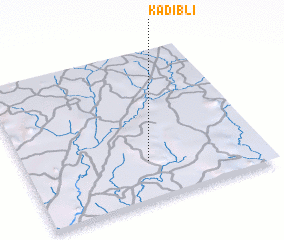 Places with similar names to Kadibli, Liberia ::
// Catabla (PH)
// Kedai Bual (MY)
// Kodobol (RU)
// Kātbaola (BD)
// Godbila (BF)
// Koudouboul (TD)
// Kitobola (CD)
// Kutabuloh (ID)
// Kutabuluh (ID)
// Ktay-Bala (UZ)
Disclaimer :: Information on this page comes without warranty of any kind |
||
|
Where is Kadibli? Elevation and coordinates ::
Latitude (lat): 6°15'39"N Longitude (lon): 9°29'14"W
Elevation (approx.): 207m (map arrows pan, magnifying glasses zoom) |
||
|
Visiting Kadibli? Hotel/Accommodation ::
Book a hotel in Kadibli Travel Guide ::
Buy a travel guide for Liberia rental cars ::
car rental offers GPS waypoint ::
download a GPX waypoint (PoI) of Kadibli for your GPS receiver
|
||