|
search place name
|
||
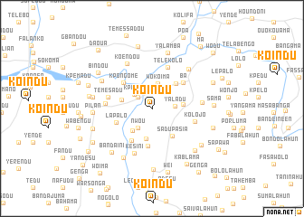
Koindu (Lofa, Liberia)Koindu is a town in the Lofa region of Liberia. An overview map of the region around Koindu is displayed below.
regional and 3d topo map of Koindu, Liberia ::
Koindu airports ::
The nearest airport is FAA - Faranah, located 185.7 km north of Koindu.
Nearby towns ::
Kolmei (2.2km north west) //
Kpando (2.7km north west) //
Yaladu (2.9km east) //
Nwou (2.9km south west) //
Wokoima (3.1km north) //
Lolo (3.6km south west) //
Bakamba (3.8km south) //
Bolilo (3.8km east) //
Kendema (3.9km west) //
Mama (4.2km north east) //
Sadu Pasia (4.2km south east) //
Kambo (4.7km south) //
Mendegesua (4.7km south west) //
Lapalo (4.7km west) //
Kpongome (4.8km north west) //
Ba (5.0km north east) //
Kpandalo (5.4km north) //
Telekolo (5.4km north) //
Kolojo (5.5km east) //
Temesadu (5.5km west) //
Kialima (5.7km west) //
Kesini (5.9km south) //
Limbalo (6.2km east) //
Koendou (6.4km north west) //
Solomba (6.6km north east) //
Ngisakonia (7.0km south west) //
Dahuma (7.0km north west) //
Yalamba (7.2km north) //
Pilan (7.2km west) //
[all distances 'as the bird flies' and approximate] 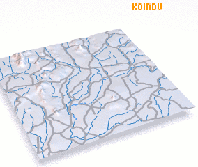 Places with similar names to Koindu, Liberia ::
Disclaimer :: Information on this page comes without warranty of any kind |
||
|
Where is Koindu? Elevation and coordinates ::
Latitude (lat): 8°27'16"N Longitude (lon): 10°12'5"W
Elevation (approx.): 443m (map arrows pan, magnifying glasses zoom) |
||
|
Visiting Koindu? Hotel/Accommodation ::
Book a hotel in Koindu Travel Guide ::
Buy a travel guide for Liberia rental cars ::
car rental offers GPS waypoint ::
download a GPX waypoint (PoI) of Koindu for your GPS receiver
|
||