|
search place name
|
||
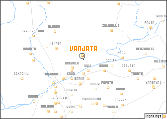
Vanjata (Bong, Liberia)Vanjata is a town in the Bong region of Liberia. An overview map of the region around Vanjata is displayed below.
regional and 3d topo map of Vanjata, Liberia ::
Vanjata airports ::
The nearest airport is ROB - Monrovia Roberts Intl, located 78.1 km south of Vanjata.
Other airports nearby include MLW - Monrovia Spriggs Payne (86.3 km south west), Nearby towns ::
Wuli (2.7km south east) //
Selekpota (3.0km south west) //
Boduala (3.1km south west) //
Yealstime (3.1km south) //
Doblita (3.2km south) //
Weamedi Creek (3.6km south west) //
Gbainkaita (4.5km south) //
Dubli (4.5km south) //
Kama (5.0km south west) //
Boima (5.4km south east) //
Banka (5.5km south) //
Wakata (5.6km south west) //
Sama (6.2km south west) //
Gonita (6.5km east) //
Wemaba (6.6km north west) //
Bingia (7.1km south) //
Ting Dowuli (8.1km south west) //
Popota (8.4km south east) //
Fodaita (8.4km south) //
Haindi (8.5km south west) //
Liniama (8.6km west) //
Meda (8.7km east) //
Gaigbelei (8.8km south west) //
Blunga (9.0km north west) //
Zulu Hills (9.1km north east) //
Sumota (9.7km south west) //
Wapai (11.5km south east) //
[all distances 'as the bird flies' and approximate]  Places with similar names to Vanjata, Liberia ::
Disclaimer :: Information on this page comes without warranty of any kind |
||
|
Where is Vanjata? Elevation and coordinates ::
Latitude (lat): 6°56'20"N Longitude (lon): 10°19'35"W
Elevation (approx.): 143m (map arrows pan, magnifying glasses zoom) |
||
|
Visiting Vanjata? Hotel/Accommodation ::
Book a hotel in Vanjata Travel Guide ::
Buy a travel guide for Liberia rental cars ::
car rental offers GPS waypoint ::
download a GPX waypoint (PoI) of Vanjata for your GPS receiver
|
||