|
search place name
|
||
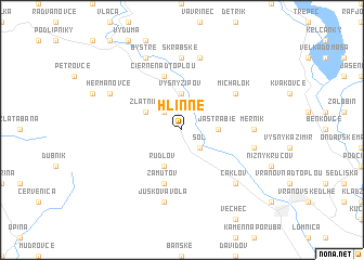
Hlinné (Slovakia)Hlinné is a town in Slovakia. An overview map of the region around Hlinné is displayed below.
regional and 3d topo map of Hlinné, Slovakia ::
Hlinné airports ::
The nearest airport is KSC - Kosice, located 40.6 km south west of Hlinné.
Other airports nearby include TAT - Poprad Tatry (99.1 km west), RZE - Rzeszow Jasionka (132.8 km north), DEB - Debrecen (162.5 km south), SUJ - Satu Mare (168.9 km south east), Nearby towns ::
Paseky (2.2km north west) //
Soľ (2.2km south east) //
Vyšný Žipov (3.7km north) //
Jastrabie (2.4km east) //
Rudlov (3.9km south) //
Zlatník (3.1km north west) //
Čierne nad Topľou (5.7km north) //
Zámutov (5.7km south) //
Michalok (5.2km north east) //
Merník (4.9km east) //
Skrabské (7.4km north) //
Juskova Voľa (7.5km south) //
Petkovce (7.5km north) //
Komárany (5.2km east) //
Čaklov (6.7km south east) //
Hermanovce (6.1km north west) //
Bystré (7.8km north) //
[all distances 'as the bird flies' and approximate] 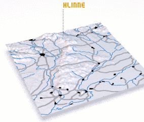 Places with similar names to Hlinné, Slovakia ::
Disclaimer :: Information on this page comes without warranty of any kind |
||
|
Where is Hlinné? Elevation and coordinates ::
Latitude (lat): 48°57'0"N Longitude (lon): 21°35'0"E
Elevation (approx.): 141m (map arrows pan, magnifying glasses zoom) |
||
|
Visiting Hlinné? Hotel/Accommodation ::
Book a hotel in Hlinné Travel Guide ::
Buy a travel guide for Slovakia rental cars ::
car rental offers GPS waypoint ::
download a GPX waypoint (PoI) of Hlinné for your GPS receiver
|
||