|
search place name
|
||
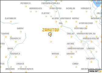
Zámutov (Slovakia)Zámutov is a town in Slovakia. An overview map of the region around Zámutov is displayed below.
regional and 3d topo map of Zámutov, Slovakia ::
Zámutov airports ::
The nearest airport is KSC - Kosice, located 35.6 km south west of Zámutov.
Other airports nearby include TAT - Poprad Tatry (98.9 km west), RZE - Rzeszow Jasionka (138.5 km north), DEB - Debrecen (156.9 km south), SUJ - Satu Mare (165.2 km south east), Nearby towns ::
Juskova Voľa (1.9km south) //
Rudlov (1.9km north) //
Soľ (4.4km north east) //
Hlinné (5.7km north) //
Čaklov (4.9km east) //
Paseky (7.4km north) //
Banské (7.5km south) //
Zlatník (7.5km north) //
Jastrabie (6.7km north east) //
Vechec (6.1km south east) //
Ilma (7.4km south east) //
Davidov (8.9km south east) //
[all distances 'as the bird flies' and approximate]  Places with similar names to Zámutov, Slovakia ::
// Summit View (US)
// Samodiva (BG)
// Zaouia Amadagh (MA)
// Summitview (US)
// Šimatovo (HR)
// Sambatova (RU)
// Smedovo (RU)
// Smedovo (RU)
Disclaimer :: Information on this page comes without warranty of any kind |
||
|
Where is Zámutov? Elevation and coordinates ::
Latitude (lat): 48°54'0"N Longitude (lon): 21°34'0"E
Elevation (approx.): 249m (map arrows pan, magnifying glasses zoom) |
||
|
Visiting Zámutov? Hotel/Accommodation ::
Book a hotel in Zámutov Travel Guide ::
Buy a travel guide for Slovakia rental cars ::
car rental offers GPS waypoint ::
download a GPX waypoint (PoI) of Zámutov for your GPS receiver
|
||