|
search place name
|
||
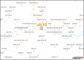
Jalná (Slovakia)Jalná is a town in Slovakia. An overview map of the region around Jalná is displayed below.
regional and 3d topo map of Jalná, Slovakia ::
Jalná airports ::
The nearest airport is SLD - Sliac, located 14.9 km north east of Jalná.
Other airports nearby include PZY - Piestany (82.8 km west), TAT - Poprad Tatry (109.4 km north east), BUD - Budapest Ferihegy (129.5 km south), BTS - Bratislava M R Stefanik (136.7 km west), Nearby towns ::
Pitelová (2.2km north west) //
Trnavá Hora (2.2km north east) //
Močiar (3.7km south) //
Kuricovci (3.7km north) //
Ladno (3.1km north east) //
Kľačany (3.9km north) //
Hrudková (5.6km south) //
Šášovské Podhradie (3.7km west) //
Hronská Dúbrava (3.7km east) //
Srnosiete (4.1km south west) //
Hronská Breznica (4.1km south east) //
Jastrabá (5.7km north) //
Stará Kremnička (4.1km north west) //
Stará Huta (4.1km north east) //
Vieska (4.9km west) //
Ihráč (7.4km north) //
Hrabiny (4.9km east) //
Ladomer (4.9km west) //
Bartošova Lehotka (7.8km north) //
Železná Breznica (6.1km north east) //
Kozelník (8.3km south east) //
[all distances 'as the bird flies' and approximate]  Places with similar names to Jalná, Slovakia ::
Disclaimer :: Information on this page comes without warranty of any kind |
||
|
Where is Jalná? Elevation and coordinates ::
Latitude (lat): 48°35'0"N Longitude (lon): 18°57'0"E
Elevation (approx.): 279m (map arrows pan, magnifying glasses zoom) |
||
|
Visiting Jalná? Hotel/Accommodation ::
Book a hotel in Jalná Travel Guide ::
Buy a travel guide for Slovakia rental cars ::
car rental offers GPS waypoint ::
download a GPX waypoint (PoI) of Jalná for your GPS receiver
|
||