|
search place name
|
||
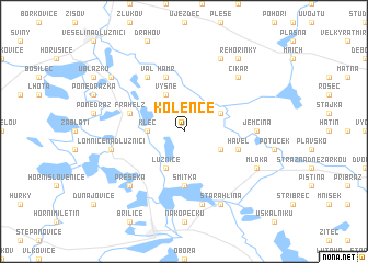
Kolence (Czech Republic)Kolence is a town in Czech Republic. An overview map of the region around Kolence is displayed below.
regional and 3d topo map of Kolence, Czech Republic ::
Kolence airports ::
The nearest airport is LNZ - Linz (Horsching), located 105.9 km south west of Kolence.
Other airports nearby include PRG - Prague Ruzyne (117.6 km north), PED - Pardubice (122.9 km north east), BRQ - Turany (139.6 km east), VIE - Vienna Schwechat (171.7 km south east), Nearby towns ::
Klec (2.4km west) //
Vyšné (3.9km north) //
Lužnice (3.9km south) //
U Bickŭ (3.1km north east) //
Novosedly nad Nežárkou (3.1km south east) //
Smítka (5.6km south) //
Kocandá (5.6km south) //
Hamr (5.7km north) //
Havel (4.1km south east) //
Frahelž (4.1km north west) //
Val (6.1km north west) //
Jemčina (4.9km east) //
Lomnice nad Lužnicí (5.2km west) //
Nová Hlína (7.5km south) //
Cikar (6.6km north east) //
Přeseka (6.6km south west) //
Mláka (6.1km south east) //
Nítovice (7.8km north) //
Stará Hlína (7.8km south) //
Vlkov (7.4km north west) //
Rehořinky (8.3km north east) //
[all distances 'as the bird flies' and approximate] 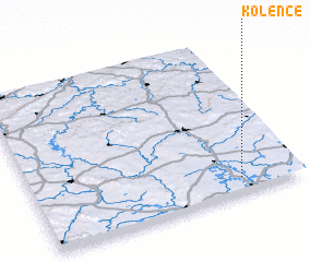 Places with similar names to Kolence, Czech Republic ::
Disclaimer :: Information on this page comes without warranty of any kind |
||
|
Where is Kolence? Elevation and coordinates ::
Latitude (lat): 49°6'0"N Longitude (lon): 14°47'0"E
Elevation (approx.): 452m (map arrows pan, magnifying glasses zoom) |
||
|
Visiting Kolence? Hotel/Accommodation ::
Book a hotel in Kolence Travel Guide ::
rental cars ::
car rental offers GPS waypoint ::
download a GPX waypoint (PoI) of Kolence for your GPS receiver
|
||