|
search place name
|
||
Rehořinky (Czech Republic)Rehořinky is a town in Czech Republic. An overview map of the region around Rehořinky is displayed below.
regional and 3d topo map of Rehořinky, Czech Republic ::

Rehořinky airports ::
The nearest airport is PRG - Prague Ruzyne, located 111.8 km north of Rehořinky.
Other airports nearby include LNZ - Linz (Horsching) (114.2 km south west), PED - Pardubice (114.7 km north east), BRQ - Turany (135.8 km east), VIE - Vienna Schwechat (173.7 km south east), Nearby towns ::
Nítovice (1.2km west) //
Cikar (1.9km south) //
Pleše (3.9km north) //
Pohoří (4.4km north east) //
Višňová (5.6km north) //
Mnich (3.6km east) //
U Bickŭ (5.7km south) //
Plasná (4.1km north east) //
Záhoří (6.1km north west) //
Újezdec (5.2km north west) //
Klenov (5.2km north east) //
Kardašova Řečice (5.2km north east) //
Závsí (7.5km north) //
Hamr (5.2km west) //
Jemčina (7.5km south) //
Lžín (7.8km north) //
Samosoly (7.8km north) //
Vyšné (6.1km south west) //
U Vojtu (6.1km north east) //
Doňov (7.4km north west) //
Kolence (8.3km south west) //
Pluhŭv Ždʼár (7.4km north east) //
[all distances 'as the bird flies' and approximate] 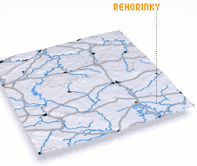 Places with similar names to Rehořinky, Czech Republic ::
// Ruhorongo (BI)
Disclaimer :: Information on this page comes without warranty of any kind |
||
|
Where is Rehořinky? Elevation and coordinates ::
Latitude (lat): 49°10'0"N Longitude (lon): 14°50'0"E
Elevation (approx.): 442m (map arrows pan, magnifying glasses zoom) |
||
|
Visiting Rehořinky? Hotel/Accommodation ::
Book a hotel in Rehořinky Travel Guide ::
rental cars ::
car rental offers GPS waypoint ::
download a GPX waypoint (PoI) of Rehořinky for your GPS receiver
|
||