|
search place name
|
||
Flegum (Nordjylland, Denmark)Flegum is a town in the Nordjylland region of Denmark. An overview map of the region around Flegum is displayed below.
regional and 3d topo map of Flegum, Denmark ::

Flegum airports ::
The nearest airport is AAL - Aalborg, located 24.4 km east of Flegum.
Other airports nearby include TED - Thisted (45.2 km west), KRP - Karup (87.9 km south), AAR - Aarhus (111.4 km south east), STA - Stauning (137.5 km south west), Nearby towns ::
Alsbjerg (1.9km south) //
Årup (2.1km north east) //
Attrup (2.1km south east) //
Lørsted (2.0km west) //
Torslev (2.0km east) //
Skovsgård (2.7km north east) //
Holmsø (2.7km south west) //
Telling (4.2km north west) //
Øster Svenstrup (4.2km north east) //
Janum (5.6km north) //
Haverslev (3.5km south west) //
Jarmsted (5.7km north) //
Tranum (7.5km north) //
Tanderup (4.4km south west) //
Stavn (6.3km south east) //
Stagsted (5.5km north west) //
Bratbjerg (8.0km north) //
[all distances 'as the bird flies' and approximate] 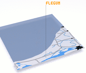 Places with similar names to Flegum, Denmark ::
// Valgom (RU)
// Val'kumey (RU)
// Flagami (US)
// Fulkum (DE)
// Veliakiemiai (LT)
// Valgma (EE)
// Valgma (EE)
// Valgma (EE)
// Valea Coma (RO)
// Ghelcam (ET)
Disclaimer :: Information on this page comes without warranty of any kind |
||
|
Where is Flegum? Elevation and coordinates ::
Latitude (lat): 57°4'0"N Longitude (lon): 9°27'0"E
Elevation (approx.): 21m (map arrows pan, magnifying glasses zoom) |
||
|
Visiting Flegum? Hotel/Accommodation ::
Book a hotel in Flegum Travel Guide ::
Buy a travel guide for Denmark rental cars ::
car rental offers GPS waypoint ::
download a GPX waypoint (PoI) of Flegum for your GPS receiver
|
||