|
search place name
|
||
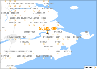
Sverdrup (Sønderjylland, Denmark)Sverdrup is a town in the Sønderjylland region of Denmark. An overview map of the region around Sverdrup is displayed below.
regional and 3d topo map of Sverdrup, Denmark ::
Sverdrup airports ::
The nearest airport is SKS - Skrydstrup, located 22.9 km west of Sverdrup.
Other airports nearby include SGD - Soenderborg Sonderborg (35.5 km south), ODE - Odense (51.0 km north east), BLL - Billund (60.4 km north west), EBJ - Esbjerg (73.3 km north west), Nearby towns ::
Kvistrup (1.1km east) //
Bæk (1.9km north) //
Stenderup (1.9km south) //
Vonsbæk (2.1km north west) //
Stevelt (2.1km east) //
Keldet (3.9km north) //
Øsby (2.8km south east) //
Grarup (3.9km south) //
Ørby (4.3km north east) //
Hyrup (4.3km south east) //
Hejsager (5.6km south) //
Knud (5.7km north) //
Hajstrup (3.7km south east) //
Sillerup (4.9km north west) //
Flovt (4.9km south east) //
Over Åstrup (4.2km west) //
Råde (4.6km south east) //
Åstrupgård (4.6km south west) //
Fjelstrup (6.4km north west) //
Lille Anslet (7.7km north) //
Kabdrup (5.6km north west) //
Halk (7.7km south) //
Lunding (5.6km south west) //
Kelstrup (8.1km south west) //
Medsted (8.5km south east) //
[all distances 'as the bird flies' and approximate] 
Disclaimer :: Information on this page comes without warranty of any kind |
||
|
Where is Sverdrup? Elevation and coordinates ::
Latitude (lat): 55°16'0"N Longitude (lon): 9°37'0"E
Elevation (approx.): 37m (map arrows pan, magnifying glasses zoom) |
||
|
Visiting Sverdrup? Hotel/Accommodation ::
Book a hotel in Sverdrup Travel Guide ::
Buy a travel guide for Denmark rental cars ::
car rental offers GPS waypoint ::
download a GPX waypoint (PoI) of Sverdrup for your GPS receiver
|
||