|
search place name
|
||
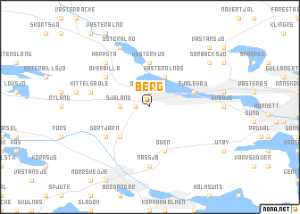
Berg (Västernorrland, Sweden)Berg is a town in the Västernorrland region of Sweden. An overview map of the region around Berg is displayed below.
regional and 3d topo map of Berg, Sweden ::
Berg airports ::
The nearest airport is OER - Ornskoldsvik, located 26.1 km north east of Berg.
Other airports nearby include KRF - Kramfors Solleftea (47.3 km south west), SDL - Sundsvall Harnosand (101.2 km south west), UME - Umea (103.1 km north east), LYC - Lycksele (141.3 km north), Nearby towns ::
Överhörnäs (1.9km north) //
Haffsta (0.8km west) //
Gälven (1.7km west) //
Själand (1.7km west) //
Österalnäs (3.8km north) //
Västeralnäs (3.8km north) //
Norrtjärn (4.1km south west) //
Västerhus (5.6km north) //
Själevad (3.1km north east) //
Bergom (5.6km south) //
Öden (5.6km south) //
Sörtjärn (4.5km south west) //
Främmerbilla (4.5km north west) //
Överbilla (4.5km north west) //
Billa (4.5km north west) //
Nässjö (7.4km south) //
Kittelsböle (3.8km north west) //
Billsta (6.1km north west) //
Happsta (6.1km north west) //
Österalnö (7.6km north) //
Sörbacksjö (6.5km north east) //
Västansjö (8.1km north east) //
Sörvästansjö (8.1km north east) //
[all distances 'as the bird flies' and approximate] 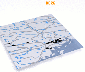 Places with similar names to Berg, Sweden ::
Disclaimer :: Information on this page comes without warranty of any kind |
||
|
Where is Berg? Elevation and coordinates ::
Latitude (lat): 63°17'0"N Longitude (lon): 18°33'0"E
(map arrows pan, magnifying glasses zoom) |
||
|
Visiting Berg? Hotel/Accommodation ::
Book a hotel in Berg Travel Guide ::
Buy a travel guide for Sweden rental cars ::
car rental offers GPS waypoint ::
download a GPX waypoint (PoI) of Berg for your GPS receiver
|
||