|
search place name
|
||
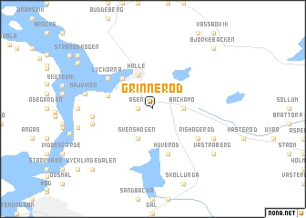
Grinneröd ((( Älvsborg )), Sweden)Grinneröd is a town in the (( Älvsborg )) region of Sweden. An overview map of the region around Grinneröd is displayed below.
regional and 3d topo map of Grinneröd, Sweden ::
nearby GPS traces from timatio ::
Grinneröd airports ::
The nearest airport is THN - Trollhattan Vanersborg, located 27.6 km north east of Grinneröd.
Other airports nearby include GSE - Gothenborg Save (45.7 km south), GOT - Gothenborg Landvetter (61.1 km south), LDK - Lidkoping (78.3 km north east), TRF - Torp (148.7 km north west), Nearby towns ::
Åsen (1.0km west) //
Backamo (2.0km east) //
Svenshögen (3.8km south) //
Hälle (4.3km north) //
Ljungskile (4.2km north west) //
Åker (3.3km north west) //
Huveröd (5.6km south) //
Rishageröd (4.7km south east) //
Lyckorna (4.7km north west) //
Gusseröd (4.0km west) //
Branseröd (4.3km south west) //
Högen (5.4km south east) //
Majviken (4.8km north west) //
Västra Berg (6.8km south east) //
Kycklingedalen (8.4km south west) //
Björkebacken (8.4km north east) //
[all distances 'as the bird flies' and approximate] 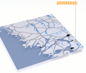 Places with similar names to Grinneröd, Sweden ::
// Grünreit (AT)
// Krannert (US)
// Kreenried (DE)
// Carenerito (CU)
// Gorna Arda (BG)
// Cornaredo (IT)
// Gránard (IE)
// Gurnard (GB)
// Granard (US)
// Grannerud (SE)
Disclaimer :: Information on this page comes without warranty of any kind |
||
|
Where is Grinneröd? Elevation and coordinates ::
Latitude (lat): 58°10'59"N Longitude (lon): 11°57'0"E
Elevation (approx.): 65m (map arrows pan, magnifying glasses zoom) |
||
|
Visiting Grinneröd? Hotel/Accommodation ::
Book a hotel in Grinneröd Travel Guide ::
Buy a travel guide for Sweden rental cars ::
car rental offers GPS waypoint ::
download a GPX waypoint (PoI) of Grinneröd for your GPS receiver
|
||