|
search place name
|
||
Backamo ((( Älvsborg )), Sweden)Backamo is a town in the (( Älvsborg )) region of Sweden. An overview map of the region around Backamo is displayed below.
regional and 3d topo map of Backamo, Sweden ::

nearby GPS traces from timatio ::
Backamo airports ::
The nearest airport is THN - Trollhattan Vanersborg, located 26.0 km north east of Backamo.
Other airports nearby include GSE - Gothenborg Save (46.0 km south), GOT - Gothenborg Landvetter (60.6 km south), LDK - Lidkoping (76.5 km north east), KVB - Skovde (120.5 km east), Nearby towns ::
Grinneröd (2.0km west) //
Rishageröd (3.8km south) //
Högen (4.2km south east) //
Åsen (2.9km west) //
Huveröd (5.6km south) //
Svenshögen (4.7km south west) //
Västra Berg (5.9km south) //
Hälle (5.1km north west) //
Ljungskile (5.4km north west) //
Hasteröd (5.4km south east) //
Björkebacken (7.7km north) //
[all distances 'as the bird flies' and approximate] 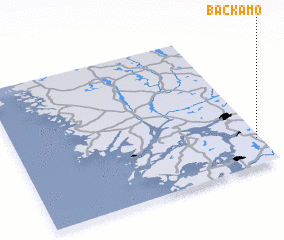 Places with similar names to Backamo, Sweden ::
// Bougma (MA)
// Bou Goummou (MA)
// Bou Goummou (MA)
// Bagam (CM)
// Bagma (CM)
// Baïgom (CM)
// Bakambé (CM)
// Bakem (CM)
// Bakem (CM)
// Bakumba (CM)
Disclaimer :: Information on this page comes without warranty of any kind |
||
|
Where is Backamo? Elevation and coordinates ::
Latitude (lat): 58°11'0"N Longitude (lon): 11°59'0"E
Elevation (approx.): 117m (map arrows pan, magnifying glasses zoom) |
||
|
Visiting Backamo? Hotel/Accommodation ::
Book a hotel in Backamo Travel Guide ::
Buy a travel guide for Sweden rental cars ::
car rental offers GPS waypoint ::
download a GPX waypoint (PoI) of Backamo for your GPS receiver
|
||