|
search place name
|
||
Härvesta (Örebro, Sweden)Härvesta is a town in the Örebro region of Sweden. An overview map of the region around Härvesta is displayed below.
regional and 3d topo map of Härvesta, Sweden ::

Härvesta airports ::
The nearest airport is ORB - Orebro, located 12.2 km north east of Härvesta.
Other airports nearby include KSK - Karlskoga (33.7 km north west), LPI - Linkoeping Saab (92.3 km south east), KVB - Skovde (93.1 km south west), NRK - Norrkoeping Kungsangen (98.2 km south east), Nearby towns ::
Håvesta (0.0km north) //
Vilsta (1.9km south) //
Skättorp (2.1km north east) //
Via (1.9km east) //
Frösvi (1.9km west) //
Helgesta (3.8km south) //
Edsberg (2.9km west) //
Frövi (2.9km west) //
Bo (2.9km east) //
Sörby (3.4km south west) //
Mossby (5.9km south) //
Fjugesta (4.7km north west) //
Norrby (3.8km east) //
Velanda (3.8km west) //
Magria (7.4km north) //
Eneby (4.2km south east) //
Västra Granhammar (7.5km north) //
Käxle (4.2km north west) //
Nedre Östa (7.5km north) //
Övre Östa (7.5km north) //
Herrgryt (7.7km south) //
Väla (7.7km south) //
Ägelsta (5.3km south west) //
Via (5.3km north west) //
Knista (7.7km north) //
Kälkesta (6.7km north west) //
Hallsberg (7.9km north) //
Körtingsberg (8.3km south west) //
[all distances 'as the bird flies' and approximate] 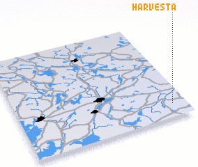 Places with similar names to Härvesta, Sweden ::
// Harvest (US)
// Harvest (US)
// Hervest (DE)
// Hervey City (US)
// Ḩarf aş Şayyād (LB)
// Ḩarf as Sādah (YE)
Disclaimer :: Information on this page comes without warranty of any kind |
||
|
Where is Härvesta? Elevation and coordinates ::
Latitude (lat): 59°8'0"N Longitude (lon): 14°55'0"E
Elevation (approx.): 77m (map arrows pan, magnifying glasses zoom) |
||
|
Visiting Härvesta? Hotel/Accommodation ::
Book a hotel in Härvesta Travel Guide ::
Buy a travel guide for Sweden rental cars ::
car rental offers GPS waypoint ::
download a GPX waypoint (PoI) of Härvesta for your GPS receiver
|
||