|
search place name
|
||
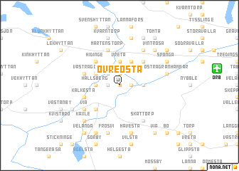
Övre Östa (Örebro, Sweden)Övre Östa is a town in the Örebro region of Sweden. An overview map of the region around Övre Östa is displayed below.
regional and 3d topo map of Övre Östa, Sweden ::
Övre Östa airports ::
The nearest airport is ORB - Orebro, located 8.3 km east of Övre Östa.
Other airports nearby include KSK - Karlskoga (28.2 km north west), KVB - Skovde (98.6 km south west), LPI - Linkoeping Saab (99.3 km south east), NRK - Norrkoeping Kungsangen (103.6 km south east), Nearby towns ::
Nedre Östa (0.0km north) //
Hidingebro (1.9km north) //
Knista (0.9km west) //
Magria (0.9km east) //
Östra Göksvalla (2.1km north west) //
Vreta (3.7km north) //
Västra Granhammar (1.9km east) //
Hallsberg (1.9km west) //
Lanna (3.8km north) //
Västra Göksvalla (2.7km north west) //
Lannabruk (4.2km north east) //
Hidinge (4.2km north west) //
Fjugesta (4.2km south west) //
Mårtenstorp (5.6km north) //
Staveläng (3.4km north west) //
Brohyttan (3.4km north west) //
Kälkesta (3.4km south west) //
Västra Via (5.9km north) //
Solberga (5.9km north) //
Via (4.7km south west) //
Skättorp (5.9km south) //
Östra Granhammar (4.2km north east) //
Älgkärr (7.5km north) //
Kvarntorp (7.5km north) //
Frösvi (7.5km south) //
Håvesta (7.5km south) //
Härvesta (7.5km south) //
Vintrosa (6.2km north east) //
Käxle (6.2km south west) //
[all distances 'as the bird flies' and approximate] 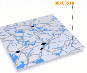 Places with similar names to Övre Östa, Sweden ::
// Översta (SE)
Disclaimer :: Information on this page comes without warranty of any kind |
||
|
Where is Övre Östa? Elevation and coordinates ::
Latitude (lat): 59°12'0"N Longitude (lon): 14°54'0"E
Elevation (approx.): 50m (map arrows pan, magnifying glasses zoom) |
||
|
Visiting Övre Östa? Hotel/Accommodation ::
Book a hotel in Övre Östa Travel Guide ::
Buy a travel guide for Sweden rental cars ::
car rental offers GPS waypoint ::
download a GPX waypoint (PoI) of Övre Östa for your GPS receiver
|
||