|
search place name
|
||
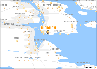
Vindhem (Västernorrland, Sweden)Vindhem is a town in the Västernorrland region of Sweden. An overview map of the region around Vindhem is displayed below.
regional and 3d topo map of Vindhem, Sweden ::
Vindhem airports ::
The nearest airport is SDL - Sundsvall Harnosand, located 19.1 km north of Vindhem.
Other airports nearby include HUV - Hudiksvall (68.2 km south), KRF - Kramfors Solleftea (78.9 km north), OER - Ornskoldsvik (141.3 km north east), GVX - Gavle (198.3 km south), Nearby towns ::
Viken (0.9km west) //
Sandarna (1.4km north west) //
Stenvik (1.6km north west) //
Ankarsvik (1.9km north west) //
Utvik (2.2km north west) //
Hamn (3.8km south) //
Myrnäs (2.7km north west) //
Karlsvik (3.7km north) //
Norra Nyhamn (3.5km south west) //
Krokudden (2.1km east) //
Bådarna (4.6km south) //
Lervik (4.9km north) //
Gustavsberg (4.9km north) //
Klampenborg (4.0km south west) //
Södra Nyhamn (4.4km south west) //
Strand (5.9km north) //
Essvik (5.1km south west) //
Ljusvik (5.7km south) //
Juniskär (6.9km south) //
Sodom (3.5km west) //
Fläsian (3.5km west) //
Nyland (6.6km south) //
Korsta (5.5km north west) //
Näsudden (3.5km east) //
Bredsand (3.7km west) //
Haraberget (6.4km south) //
Usland (7.4km north) //
Stockvik (4.3km south west) //
Juni (8.2km south) //
[all distances 'as the bird flies' and approximate]  Places with similar names to Vindhem, Sweden ::
// Vindheim (NO)
Disclaimer :: Information on this page comes without warranty of any kind |
||
|
Where is Vindhem? Elevation and coordinates ::
Latitude (lat): 62°21'26"N Longitude (lon): 17°26'10"E
(map arrows pan, magnifying glasses zoom) |
||
|
Visiting Vindhem? Hotel/Accommodation ::
Book a hotel in Vindhem Travel Guide ::
Buy a travel guide for Sweden rental cars ::
car rental offers GPS waypoint ::
download a GPX waypoint (PoI) of Vindhem for your GPS receiver
|
||