|
search place name
|
||
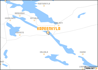
Kapeenkylä (Länsi-Suomen Lääni, Finland)Kapeenkylä is a town in the Länsi-Suomen Lääni region of Finland. An overview map of the region around Kapeenkylä is displayed below.
regional and 3d topo map of Kapeenkylä, Finland ::
Kapeenkylä airports ::
The nearest airport is JYV - Jyvaskyla, located 16.9 km south west of Kapeenkylä.
Other airports nearby include KEV - Halli (93.1 km south west), KUO - Kuopio (113.4 km north east), MIK - Mikkeli (118.4 km south east), QVY - Utti (191.5 km south), Nearby towns ::
 Places with similar names to Kapeenkylä, Finland ::
// Kepenekli (TR)
// Kapongolo (CD)
// Kaïpongal (SN)
// Kipounigali (SN)
// Kapangala (ZM)
// Kapangula (ZM)
// Kapangula (ZM)
// Kipp'un-gol (KP)
// Kip'ŭn-gol (KP)
// Kip'un-gol (KR)
Disclaimer :: Information on this page comes without warranty of any kind |
||
|
Where is Kapeenkylä? Elevation and coordinates ::
Latitude (lat): 62°32'0"N Longitude (lon): 25°50'0"E
(map arrows pan, magnifying glasses zoom) |
||
|
Visiting Kapeenkylä? Hotel/Accommodation ::
Book a hotel in Kapeenkylä Travel Guide ::
Buy a travel guide for Finland rental cars ::
car rental offers GPS waypoint ::
download a GPX waypoint (PoI) of Kapeenkylä for your GPS receiver
|
||