|
search place name
|
||
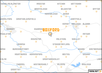
Boxford (United Kingdom)Boxford is a town in United Kingdom. An overview map of the region around Boxford is displayed below.
regional and 3d topo map of Boxford, United Kingdom ::
Boxford airports ::
The nearest airport is BEQ - Honington, located 36.8 km north of Boxford.
Other airports nearby include STN - London Stansted (45.8 km west), MHZ - Mildenhall (46.4 km north west), SEN - Southend (50.9 km south), CBG - Cambridge (51.8 km north west), Nearby towns ::
Polstead (2.9km south east) //
Edwardstone (2.9km north west) //
Nayland (3.9km south) //
Stoke by Nayland (4.4km south east) //
Assington (3.9km south west) //
Kersey (5.0km north east) //
Monks Eleigh (7.4km north) //
Wissington (7.5km south) //
Chelsworth (7.8km north) //
Semer (8.2km north east) //
Boxted (8.2km south east) //
Wormingford (8.2km south west) //
[all distances 'as the bird flies' and approximate] 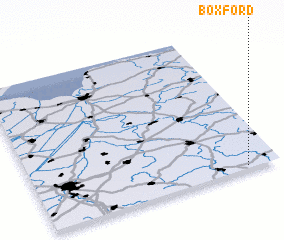 Places with similar names to Boxford, United Kingdom ::
Disclaimer :: Information on this page comes without warranty of any kind |
||
|
Where is Boxford? Elevation and coordinates ::
Latitude (lat): 52°1'0"N Longitude (lon): 0°52'0"W
Elevation (approx.): 24m (map arrows pan, magnifying glasses zoom) |
||
|
Visiting Boxford? Hotel/Accommodation ::
Book a hotel in Boxford Travel Guide ::
rental cars ::
car rental offers GPS waypoint ::
download a GPX waypoint (PoI) of Boxford for your GPS receiver
|
||