|
search place name
|
||
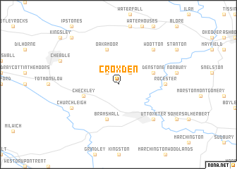
Croxden (United Kingdom)Croxden is a town in United Kingdom. An overview map of the region around Croxden is displayed below.
regional and 3d topo map of Croxden, United Kingdom ::
Croxden airports ::
The nearest airport is EMA - Nottingham East Midlands, located 40.7 km east of Croxden.
Other airports nearby include MAN - Manchester (51.5 km north west), BHX - Birmingham (56.2 km south), CVT - Coventry (70.6 km south east), LPL - Liverpool (76.6 km north west), Nearby towns ::
Alton (2.2km north east) //
Bradley in the Moors (2.2km north west) //
Oakamoor (5.7km north) //
Denstone (3.8km north east) //
Checkley (3.8km south west) //
Bramshall (5.7km south) //
Rocester (4.5km east) //
Wootton (6.5km north east) //
Uttoxeter (6.5km south east) //
Church Leigh (5.8km south west) //
Froghall (8.7km north west) //
[all distances 'as the bird flies' and approximate]  Places with similar names to Croxden, United Kingdom ::
// Grigston (US)
// Kregždėnai (LT)
// Kregždyne (LT)
// Krekštėnai (LT)
// Krikštėnai (LT)
// Croxton (US)
// Griggstown (US)
// Karagastenna (LK)
// Karagastenna (LK)
// Gurgu Sudan (NG)
Disclaimer :: Information on this page comes without warranty of any kind |
||
|
Where is Croxden? Elevation and coordinates ::
Latitude (lat): 52°57'0"N Longitude (lon): 1°54'0"W
Elevation (approx.): 133m (map arrows pan, magnifying glasses zoom) |
||
|
Visiting Croxden? Hotel/Accommodation ::
Book a hotel in Croxden Travel Guide ::
rental cars ::
car rental offers GPS waypoint ::
download a GPX waypoint (PoI) of Croxden for your GPS receiver
|
||