|
search place name
|
||
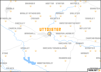
Uttoxeter (United Kingdom)Uttoxeter is a town in United Kingdom. An overview map of the region around Uttoxeter is displayed below.
regional and 3d topo map of Uttoxeter, United Kingdom ::
Uttoxeter airports ::
The nearest airport is EMA - Nottingham East Midlands, located 36.0 km east of Uttoxeter.
Other airports nearby include BHX - Birmingham (50.1 km south), MAN - Manchester (58.0 km north west), CVT - Coventry (64.1 km south east), CEG - Hawarden (81.7 km north west), Nearby towns ::
Doveridge (2.2km east) //
Somersal Herbert (3.4km east) //
Marchington Woodlands (5.7km south) //
Rocester (5.7km north) //
Marchington (5.0km south east) //
Denstone (7.4km north) //
Bramshall (4.5km west) //
Kingston (6.5km south west) //
Croxden (6.5km north west) //
Alton (7.7km north) //
Norbury (7.7km north) //
Ellastone (7.7km north) //
Marston Montgomery (5.8km north east) //
Bradley in the Moors (8.7km north west) //
[all distances 'as the bird flies' and approximate] 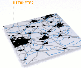 Places with similar names to Uttoxeter, United Kingdom :: Disclaimer :: Information on this page comes without warranty of any kind |
||
|
Where is Uttoxeter? Elevation and coordinates ::
Latitude (lat): 52°54'0"N Longitude (lon): 1°51'0"W
Elevation (approx.): 78m (map arrows pan, magnifying glasses zoom) |
||
|
Visiting Uttoxeter? Hotel/Accommodation ::
Book a hotel in Uttoxeter Travel Guide ::
rental cars ::
car rental offers GPS waypoint ::
download a GPX waypoint (PoI) of Uttoxeter for your GPS receiver
|
||