|
search place name
|
||
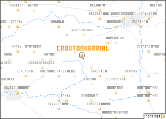
Croxton Kerrial (United Kingdom)Croxton Kerrial is a town in United Kingdom. An overview map of the region around Croxton Kerrial is displayed below.
regional and 3d topo map of Croxton Kerrial, United Kingdom ::
Croxton Kerrial airports ::
The nearest airport is EMA - Nottingham East Midlands, located 39.0 km west of Croxton Kerrial.
Other airports nearby include WTN - Waddington (40.0 km north), QCY - Coningsby (48.7 km north east), CVT - Coventry (71.5 km south west), BHX - Birmingham (79.7 km south west), Nearby towns ::
Saltby (2.2km south east) //
Knipton (2.2km north west) //
Stonesby (3.9km south) //
Sproxton (4.3km south east) //
Woolsthorpe (5.6km north) //
Coston (5.7km south) //
Belvoir (6.0km north) //
Waltham on the Wolds (5.0km south west) //
Denton (5.0km north east) //
Eaton (4.5km west) //
Harlaxton (5.8km north east) //
Buckminster (7.1km south east) //
Redmile (8.1km north west) //
Sewstern (8.7km south east) //
Barrowby (8.7km north east) //
[all distances 'as the bird flies' and approximate] 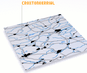 Places with similar names to Croxton Kerrial, United Kingdom :: Disclaimer :: Information on this page comes without warranty of any kind |
||
|
Where is Croxton Kerrial? Elevation and coordinates ::
Latitude (lat): 52°50'0"N Longitude (lon): 0°45'0"W
Elevation (approx.): 134m (map arrows pan, magnifying glasses zoom) |
||
|
Visiting Croxton Kerrial? Hotel/Accommodation ::
Book a hotel in Croxton Kerrial Travel Guide ::
rental cars ::
car rental offers GPS waypoint ::
download a GPX waypoint (PoI) of Croxton Kerrial for your GPS receiver
|
||