|
search place name
|
||
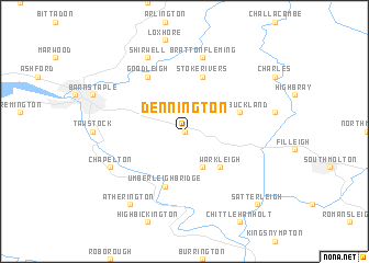
Dennington (United Kingdom)Dennington is a town in United Kingdom. An overview map of the region around Dennington is displayed below.
regional and 3d topo map of Dennington, United Kingdom ::
Dennington airports ::
The nearest airport is EXT - Exeter, located 52.4 km south east of Dennington.
Other airports nearby include CWL - Cardiff (58.2 km north east), SWS - Swansea (62.2 km north), PLH - Plymouth (70.5 km south), YEO - Yeovilton (93.3 km east), Nearby towns ::
Swimbridge (0.0km north) //
Chittlehampton (3.9km south) //
Warkleigh (4.4km south east) //
Umberleigh Bridge (5.7km south) //
West Buckland (4.0km north east) //
Stoke Rivers (5.7km north) //
Goodleigh (6.0km north west) //
Bratton Fleming (7.5km north) //
Chapelton (6.0km south west) //
Shirwell (7.8km north) //
Atherington (8.2km south west) //
Satterleigh (8.8km south east) //
[all distances 'as the bird flies' and approximate]  Places with similar names to Dennington, United Kingdom ::
// Dunnington (US)
// Dunnington (US)
// Donnington (ZA)
// Downingtown (US)
// Dunningtown (US)
// Donnington (ZW)
// Donnington (GB)
// Dennington (AU)
// Donghuangdian (CN)
// Dennington (GB)
Disclaimer :: Information on this page comes without warranty of any kind |
||
|
Where is Dennington? Elevation and coordinates ::
Latitude (lat): 51°3'0"N Longitude (lon): 3°58'0"W
Elevation (approx.): 123m (map arrows pan, magnifying glasses zoom) |
||
|
Visiting Dennington? Hotel/Accommodation ::
Book a hotel in Dennington Travel Guide ::
rental cars ::
car rental offers GPS waypoint ::
download a GPX waypoint (PoI) of Dennington for your GPS receiver
|
||