|
search place name
|
||
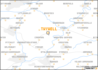
Twywell (United Kingdom)Twywell is a town in United Kingdom. An overview map of the region around Twywell is displayed below.
regional and 3d topo map of Twywell, United Kingdom ::
nearby GPS traces from timatio ::
Twywell airports ::
The nearest airport is CBG - Cambridge, located 56.5 km east of Twywell.
Other airports nearby include LTN - London Luton (58.8 km south), CVT - Coventry (59.9 km west), EMA - Nottingham East Midlands (70.1 km north west), MHZ - Mildenhall (74.0 km east), Nearby towns ::
Woodford (2.9km south east) //
Cranford (2.9km south west) //
Great Addington (3.9km south) //
Grafton Underwood (2.9km north west) //
Sudborough (4.3km north east) //
Lowick (3.9km north east) //
Ringstead (5.0km south east) //
Finedon (6.0km south) //
Irthlingborough (7.4km south) //
Islip (4.5km east) //
Brigstock (7.4km north) //
Denford (4.9km east) //
Thrapston (4.9km east) //
Burton Latimer (5.9km south west) //
Stanwick (8.2km south east) //
Raunds (7.2km south east) //
[all distances 'as the bird flies' and approximate]  Places with similar names to Twywell, United Kingdom ::
Disclaimer :: Information on this page comes without warranty of any kind |
||
|
Where is Twywell? Elevation and coordinates ::
Latitude (lat): 52°23'0"N Longitude (lon): 0°36'0"W
Elevation (approx.): 67m (map arrows pan, magnifying glasses zoom) |
||
|
Visiting Twywell? Hotel/Accommodation ::
Book a hotel in Twywell Travel Guide ::
rental cars ::
car rental offers GPS waypoint ::
download a GPX waypoint (PoI) of Twywell for your GPS receiver
|
||