|
search place name
|
||
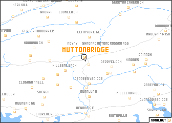
Mutton Bridge (Corcaigh, Ireland)Mutton Bridge is a town in the Corcaigh region of Ireland. An overview map of the region around Mutton Bridge is displayed below.
regional and 3d topo map of Mutton Bridge, Ireland ::
Mutton Bridge airports ::
The nearest airport is ORK - Cork, located 57.7 km east of Mutton Bridge.
Other airports nearby include KIR - Kerry (60.8 km north), SNN - Shannon (118.7 km north), GWY - Galway (184.3 km north), Nearby towns ::
Drom dhá Liag (0.8km south east) //
Drimoleague (0.8km south east) //
Moyny Bridge (2.1km north) //
Bishops Village (2.4km south west) //
Moyny (3.4km north west) //
Killeenleagh (3.4km south west) //
Derreeny Bridge (4.9km south) //
Shronacarton Cross Roads (3.9km north east) //
Bredagh Cross Roads (3.9km south east) //
Leitry Bridge (5.4km north) //
Derryclogh (3.7km east) //
Bauravilla (5.7km south) //
Driminidy (4.2km south east) //
Carrig (6.0km south) //
Barna Cross Roads (4.8km south west) //
Runalunn (7.7km south) //
Aghaville Cross Roads (4.9km west) //
Red Cross Roads (6.4km south west) //
Barnagowlane (8.6km north) //
Glandart (6.6km north west) //
[all distances 'as the bird flies' and approximate] 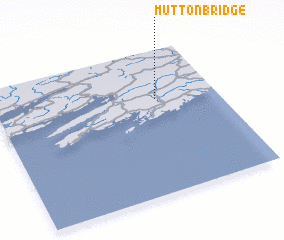 Places with similar names to Mutton Bridge, Ireland :: Disclaimer :: Information on this page comes without warranty of any kind |
||
|
Where is Mutton Bridge? Elevation and coordinates ::
Latitude (lat): 51°39'24"N Longitude (lon): 9°16'21"W
Elevation (approx.): 66m (map arrows pan, magnifying glasses zoom) |
||
|
Visiting Mutton Bridge? Hotel/Accommodation ::
Book a hotel in Mutton Bridge Travel Guide ::
Buy a travel guide for Ireland rental cars ::
car rental offers GPS waypoint ::
download a GPX waypoint (PoI) of Mutton Bridge for your GPS receiver
|
||