|
search place name
|
||
Rathernan Bridge (Carlow, Ireland)Rathernan Bridge is a town in the Carlow region of Ireland. An overview map of the region around Rathernan Bridge is displayed below.
regional and 3d topo map of Rathernan Bridge, Ireland ::

Rathernan Bridge airports ::
The nearest airport is WAT - Waterford, located 63.8 km south of Rathernan Bridge.
Other airports nearby include DUB - Dublin (87.7 km north east), SNN - Shannon (132.0 km west), ORK - Cork (145.2 km south west), GWY - Galway (145.3 km north west), Nearby towns ::
Orchard Bridge (1.1km east) //
Leithghlinn an Droichid (2.2km south) //
Leighlinbridge (2.2km south) //
Farranatreney (3.3km south) //
The Harrow (2.8km south east) //
Oldleighlin (3.9km south west) //
Royaloak (6.3km south) //
Rathedan Cross Roads (5.2km south east) //
Muine Bheag (6.8km south) //
An Urnaí (4.3km east) //
Nurney (4.3km east) //
Philip Street (7.1km south) //
Ballyrvan (4.5km east) //
Reddyʼs Cross Roads (6.2km south west) //
Rossmore (7.4km north) //
Crockaun (8.2km north) //
Hooperʼs Cross Roads (5.4km south east) //
Ballymoon (7.1km south east) //
Bilboa (6.3km north west) //
Tomnasock (5.9km south west) //
Graigue (8.8km north) //
Seskinryan (8.7km south) //
Cranroe (7.2km south west) //
Baile Phóil (9.0km south) //
Paulstown (9.0km south) //
Coorleagh (8.2km south west) //
Swinn Cross Roads (8.6km south east) //
[all distances 'as the bird flies' and approximate] 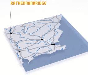 Places with similar names to Rathernan Bridge, Ireland ::
// Rathrnane Bridge (IE)
Disclaimer :: Information on this page comes without warranty of any kind |
||
|
Where is Rathernan Bridge? Elevation and coordinates ::
Latitude (lat): 52°45'23"N Longitude (lon): 6°58'22"W
Elevation (approx.): 49m (map arrows pan, magnifying glasses zoom) |
||
|
Visiting Rathernan Bridge? Hotel/Accommodation ::
Book a hotel in Rathernan Bridge Travel Guide ::
Buy a travel guide for Ireland rental cars ::
car rental offers GPS waypoint ::
download a GPX waypoint (PoI) of Rathernan Bridge for your GPS receiver
|
||