|
search place name
|
||
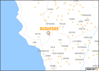
Akoursos (Cyprus)Akoursos is a town in Cyprus. An overview map of the region around Akoursos is displayed below.
regional and 3d topo map of Akoursos, Cyprus ::
Akoursos airports ::
The nearest airport is PFO - Paphos Pafos Intl, located 19.7 km south of Akoursos.
Other airports nearby include AKT - Akrotiri (61.5 km south east), LCA - Larnaca (110.1 km east), Nearby towns ::
Kathikas (3.3km north) //
Peyia (3.5km west) //
Theletra (4.4km north east) //
Kili (4.4km south east) //
Pano Arodhes (5.7km north) //
Tala (5.7km south) //
Yiolou (5.3km north east) //
Kato Arodhes (6.2km north) //
Pano Akourdhalia (6.4km north) //
Maa (5.9km south west) //
Kritou Terra (7.0km north) //
Stroumbi (5.7km east) //
Kissonerga (7.2km south) //
Miliou (7.1km north east) //
Tsadha (7.1km south east) //
Kato Akourdhalia (7.9km north) //
Aşağıkardali (7.9km north) //
Inia (8.3km north) //
Trimithousa (8.3km south) //
Dhrousha (8.6km north) //
Loukrounou (8.3km north east) //
Polemi (7.2km east) //
Lemba (8.8km south) //
Terra (8.8km north) //
Emba (8.8km south) //
Mesoyi (8.6km south east) //
Mesa Khorio (9.6km south east) //
Kallepia (8.6km south east) //
Simou (8.8km north east) //
[all distances 'as the bird flies' and approximate] 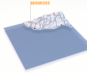 Places with similar names to Akoursos, Cyprus ::
// Akarzaza (NE)
Disclaimer :: Information on this page comes without warranty of any kind |
||
|
Where is Akoursos? Elevation and coordinates ::
Latitude (lat): 34°53'15"N Longitude (lon): 32°25'15"E
Elevation (approx.): 444m (map arrows pan, magnifying glasses zoom) |
||
|
Visiting Akoursos? Hotel/Accommodation ::
Book a hotel in Akoursos Travel Guide ::
Buy a travel guide for Cyprus rental cars ::
car rental offers GPS waypoint ::
download a GPX waypoint (PoI) of Akoursos for your GPS receiver
|
||