|
search place name
|
||
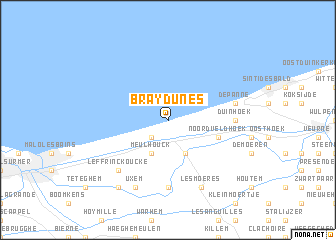
Bray-Dunes (Nord-Pas-de-Calais, France)Bray-Dunes is a town in the Nord-Pas-de-Calais region of France. An overview map of the region around Bray-Dunes is displayed below.
regional and 3d topo map of Bray-Dunes, France ::
Bray-Dunes airports ::
The nearest airport is OST - Oostende, located 27.4 km north east of Bray-Dunes.
Other airports nearby include CQF - Calais Dunkerque (41.7 km west), QKT - Kortrijk-vevelgem Wevelgem (56.7 km south east), LIL - Lille Lesquin (70.7 km south east), MSE - Manston (86.7 km west), Nearby towns ::
Zuydcoote (2.2km south west) //
Ghyvelde (3.9km south) //
Meulhouck (3.9km south) //
Noordveldhoek (4.0km south east) //
Krommen Houck (7.4km south) //
Duinhoek (4.7km east) //
De Panne (5.0km east) //
Leffrinckoucke (6.6km south west) //
Les Moëres (7.8km south) //
Uxem (7.8km south) //
Tlegerveld (8.2km south west) //
[all distances 'as the bird flies' and approximate] 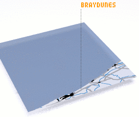 Places with similar names to Bray-Dunes, France ::
// Breitensee (AT)
// Breitensee (AT)
// Breitensee (DE)
// Bardonazzi (IT)
// Bartnes (NO)
// Bertnes (NO)
// Børtnes (NO)
// Brudnice (PL)
// Bratanići (BA)
// Bordones (ES)
Disclaimer :: Information on this page comes without warranty of any kind |
||
|
Where is Bray-Dunes? Elevation and coordinates ::
Latitude (lat): 51°5'0"N Longitude (lon): 2°31'0"E
Elevation (approx.): -32768m (map arrows pan, magnifying glasses zoom) |
||
|
Visiting Bray-Dunes? Hotel/Accommodation ::
Book a hotel in Bray-Dunes Travel Guide ::
Buy a travel guide for France rental cars ::
car rental offers GPS waypoint ::
download a GPX waypoint (PoI) of Bray-Dunes for your GPS receiver
|
||