|
search place name
|
||
Bussy-en-Othe (Bourgogne, France)Bussy-en-Othe is a town in the Bourgogne region of France. An overview map of the region around Bussy-en-Othe is displayed below.
regional and 3d topo map of Bussy-en-Othe, France ::

Bussy-en-Othe airports ::
The nearest airport is AUF - Auxerre Branches, located 18.6 km south of Bussy-en-Othe.
Other airports nearby include QYR - Troyes Barberey (50.4 km north east), ORY - Paris Orly (116.4 km north west), NVS - Nevers Fourchambault (116.8 km south), ORE - Orleans Bricy (131.1 km west), Nearby towns ::
La Ramée (2.2km north east) //
Bailly (2.2km north east) //
Villepied (2.5km east) //
Lopers (3.9km south) //
Brion (3.1km south west) //
Vorvigny (3.7km east) //
La Fourchotte (3.7km west) //
Laroche-Saint-Cydroine (5.6km south) //
Migennes (5.6km south) //
Paroy-en-Othe (4.2km north east) //
Cheny (7.5km south) //
Saint-Cydroine (6.7km south west) //
Dilo (7.8km north) //
Esnon (6.2km south east) //
La Grande Vallée (7.4km north west) //
Ormoy (8.3km south east) //
Épineau-les-Voves (8.3km south west) //
Le Charme (8.9km north east) //
La Borde à la Gousse (8.9km north west) //
Grange Bertin (8.9km north west) //
[all distances 'as the bird flies' and approximate] 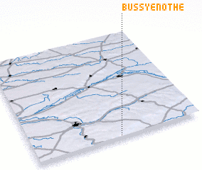 Places with similar names to Bussy-en-Othe, France ::
// Bucey-en-Othe (FR)
Disclaimer :: Information on this page comes without warranty of any kind |
||
|
Where is Bussy-en-Othe? Elevation and coordinates ::
Latitude (lat): 48°1'0"N Longitude (lon): 3°31'0"E
Elevation (approx.): 145m (map arrows pan, magnifying glasses zoom) |
||
|
Visiting Bussy-en-Othe? Hotel/Accommodation ::
Book a hotel in Bussy-en-Othe Travel Guide ::
Buy a travel guide for France rental cars ::
car rental offers GPS waypoint ::
download a GPX waypoint (PoI) of Bussy-en-Othe for your GPS receiver
|
||