|
search place name
|
||
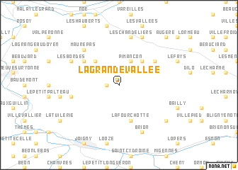
La Grande Vallée (Bourgogne, France)La Grande Vallée is a town in the Bourgogne region of France. An overview map of the region around La Grande Vallée is displayed below.
regional and 3d topo map of La Grande Vallée, France ::
La Grande Vallée airports ::
The nearest airport is AUF - Auxerre Branches, located 24.3 km south of La Grande Vallée.
Other airports nearby include QYR - Troyes Barberey (50.8 km north east), ORY - Paris Orly (109.0 km north west), NVS - Nevers Fourchambault (121.0 km south), CDG - Paris Charles De Gaulle (124.4 km north west), Nearby towns ::
La Borde à la Gousse (1.9km north) //
Grange Bertin (1.9km north) //
La Tuilerie (1.2km west) //
Dixmont (3.1km north west) //
Pimançon (3.9km north) //
Les Pommerats (4.5km north east) //
Grange Pourrain (4.5km north west) //
La Fourchotte (5.7km south) //
Villechétive (5.2km north east) //
Clos Aubry (5.2km north west) //
Les Chandeliers (7.5km north) //
Les Bocquins (5.3km west) //
Les Bruleries (5.3km west) //
Maurepas (6.7km north west) //
Cerisiers (7.8km north) //
Brion (7.8km south) //
Les Bordes (6.2km north west) //
Bussy-en-Othe (7.4km south east) //
Augère (8.9km north east) //
[all distances 'as the bird flies' and approximate]  Places with similar names to La Grande Vallée, France ::
// La Grandville (FR)
// La Grande-Folie (FR)
// La Grande Vallée (FR)
// La Grande Vallée (FR)
// La Grande Ville (FR)
// La Grandville (FR)
// Le Grand Valluy (FR)
// Le Grand Vieil (FR)
Disclaimer :: Information on this page comes without warranty of any kind |
||
|
Where is La Grande Vallée? Elevation and coordinates ::
Latitude (lat): 48°4'0"N Longitude (lon): 3°27'0"E
Elevation (approx.): 214m (map arrows pan, magnifying glasses zoom) |
||
|
Visiting La Grande Vallée? Hotel/Accommodation ::
Book a hotel in La Grande Vallée Travel Guide ::
Buy a travel guide for France rental cars ::
car rental offers GPS waypoint ::
download a GPX waypoint (PoI) of La Grande Vallée for your GPS receiver
|
||