|
search place name
|
||
Cambo (Languedoc-Roussillon, France)Cambo is a town in the Languedoc-Roussillon region of France. An overview map of the region around Cambo is displayed below.
regional and 3d topo map of Cambo, France ::

Cambo airports ::
The nearest airport is MPL - Montpellier Mediterranee, located 45.3 km south of Cambo.
Other airports nearby include FNI - Nimes Garons (54.7 km south east), MEN - Mende Brenoux (63.2 km north), OBS - Aubenas-vals-lanas Ardeche Meridionale (78.8 km north east), BZR - Beziers Vias (80.0 km south west), Nearby towns ::
La Cadière (1.9km south) //
Cézas (2.7km west) //
Montoulieu (3.7km south) //
Cros (3.2km north east) //
Saint-Roman-de-Codières (3.9km north) //
Saint-Hippolyte-du-Fort (4.0km east) //
Bouzons (7.4km north) //
Colognac (7.5km north) //
Agonès (6.9km south west) //
Saint-Bonnet (8.4km north east) //
Laroque (7.7km south west) //
Pompignan (8.4km south east) //
Saint-Martial (9.1km north west) //
Saint-Bauzille-de-Putois (9.1km south west) //
[all distances 'as the bird flies' and approximate] 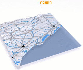 Places with similar names to Cambo, France ::
Disclaimer :: Information on this page comes without warranty of any kind |
||
|
Where is Cambo? Elevation and coordinates ::
Latitude (lat): 43°58'0"N Longitude (lon): 3°48'0"E
Elevation (approx.): 465m (map arrows pan, magnifying glasses zoom) |
||
|
Visiting Cambo? Hotel/Accommodation ::
Book a hotel in Cambo Travel Guide ::
Buy a travel guide for France rental cars ::
car rental offers GPS waypoint ::
download a GPX waypoint (PoI) of Cambo for your GPS receiver
|
||