|
search place name
|
||
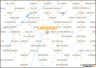
Charassat (Auvergne, France)Charassat is a town in the Auvergne region of France. An overview map of the region around Charassat is displayed below.
regional and 3d topo map of Charassat, France ::
Charassat airports ::
The nearest airport is MCU - Montlucon-gueret Montlucon Gueret, located 18.0 km west of Charassat.
Other airports nearby include MCU - Montlucon Domerat (20.7 km north), CFE - Clermont Ferrand Auvergne (62.0 km south east), VHY - Vichy Charmeil (63.4 km east), XMU - Moulins Montbeugny (76.5 km north east), Nearby towns ::
Les Vincents (1.3km west) //
Saint-Marcel-en-Marcillat (1.9km south) //
Le Peux (2.3km north west) //
Les Bougerolles (2.3km north east) //
Romagère-aux-Osiers (2.6km east) //
Le Gentioux (3.2km north west) //
Chambonchard (3.2km north west) //
La Petite-Marche (3.9km north) //
Clautrier (3.9km south) //
Chabanusse (3.9km south) //
Terjat (4.5km north east) //
Les Fayes (4.5km north east) //
Roche (4.5km south west) //
Villejaleix (4.5km south east) //
Fredfond (5.6km north) //
Marcillat-en-Combraille (3.9km east) //
Le Theix (3.9km west) //
Les Châtres (5.7km north) //
Le Breuil (5.7km north) //
Manbouy (5.7km south) //
Château-sur-Cher (6.1km south west) //
Bourassat (6.1km north west) //
Les Ribières Basses (5.3km north east) //
Les Ribières Hautes (5.3km north east) //
La Rue (6.1km south east) //
Saint-Fargeol (5.3km south east) //
Lonlevade (5.3km south west) //
Vrolle (7.4km north) //
Teillet (5.1km west) //
[all distances 'as the bird flies' and approximate] 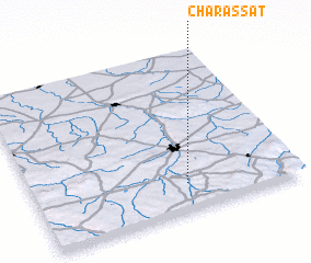 Places with similar names to Charassat, France ::
// Cherăşti (RO)
// Chiorăşti (RO)
// Cherusti (RU)
// Chāh Rāsteh (IR)
// Cherry City (US)
// Char Sita (BD)
// Shirsadi (IN)
// Tiar Sodi (SN)
// Chārsadda (PK)
// Chârost (FR)
Disclaimer :: Information on this page comes without warranty of any kind |
||
|
Where is Charassat? Elevation and coordinates ::
Latitude (lat): 46°10'0"N Longitude (lon): 2°35'0"E
Elevation (approx.): 482m (map arrows pan, magnifying glasses zoom) |
||
|
Visiting Charassat? Hotel/Accommodation ::
Book a hotel in Charassat Travel Guide ::
Buy a travel guide for France rental cars ::
car rental offers GPS waypoint ::
download a GPX waypoint (PoI) of Charassat for your GPS receiver
|
||