|
search place name
|
||
Contay (Picardie, France)Contay is a town in the Picardie region of France. An overview map of the region around Contay is displayed below.
regional and 3d topo map of Contay, France ::

Contay airports ::
The nearest airport is BVA - Beauvais Tille, located 66.3 km south west of Contay.
Other airports nearby include LIL - Lille Lesquin (76.0 km north east), CSF - Creil (83.1 km south), LTQ - Le Tourquet Le Touquet Paris Plage (84.2 km north west), QKT - Kortrijk-vevelgem Wevelgem (104.4 km north east), Nearby towns ::
Vadencourt (0.0km north) //
Baizieux (2.4km east) //
Beaucourt-sur-lʼHallue (3.0km south west) //
Bavelincourt (3.0km south west) //
Franvillers (3.9km south) //
Warloy-Baillon (3.0km north east) //
Toutencourt (4.4km north west) //
Montigny-sur-lʼHallue (4.4km south west) //
Harponville (4.4km north east) //
Lahoussoye (5.6km south) //
Béhencourt (5.1km south west) //
Arquèves (7.4km north) //
Hérissart (5.1km west) //
Heilly (6.6km south east) //
Varennes (6.6km north east) //
Fréchencourt (6.6km south west) //
Pont-Noyelles (7.8km south) //
Bonnay (7.8km south) //
Léalvillers (7.8km north) //
Saint-Gratien (7.3km south west) //
Puchevillers (7.3km north west) //
Acheux-en-Amiénois (8.2km north east) //
Raincheval (8.2km north west) //
Querrieu (8.8km south west) //
[all distances 'as the bird flies' and approximate] 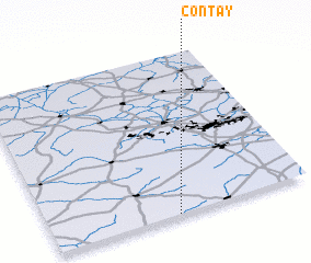 Places with similar names to Contay, France ::
Disclaimer :: Information on this page comes without warranty of any kind |
||
|
Where is Contay? Elevation and coordinates ::
Latitude (lat): 50°0'0"N Longitude (lon): 2°29'0"E
Elevation (approx.): 66m (map arrows pan, magnifying glasses zoom) |
||
|
Visiting Contay? Hotel/Accommodation ::
Book a hotel in Contay Travel Guide ::
Buy a travel guide for France rental cars ::
car rental offers GPS waypoint ::
download a GPX waypoint (PoI) of Contay for your GPS receiver
|
||